
The Nullarbor Plain is approximately 200,000 square kilometres and is a 1,000 km drive to cross. The area is riddled with sink holes and caves, some of them containing water. Most of the caves are a long way from the main road on a dirt track through very barren landscape!

Here's one of the Murrawijinie Caves.....

.... and the Bunda Cliffs along the Nullarbor coast.

From Balladonia (where most of the US Skylab fell out of the sky in 1979) we turned south to Cape Arid National Park. The track was very rough at times with corrugations, rocks, sand and dried-up mud where people got bogged. A 200 km drive took over 8 hours!


Of course we had to climb Mount Ragged along the way!


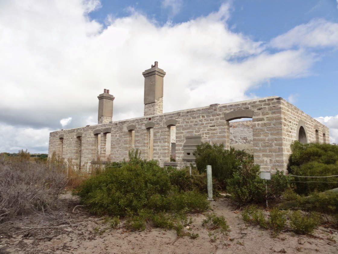
Israelite Bay was a significant telegraph station in the early 1900s, now there is nothing but sand and the ruin of the old building! Note the mail box at the front facade of the building!
We camped at Thomas River and did some of the walks along the coast. Gorgeous!


The sand is very fine and white and the water is very clear.

Cape Le Grand National Park is not to be missed! Here's Frenchman Peak with its giant arch. From the top there is a fantastic view of the Recherche Archipelago.


The weather was just perfect with hot days and cool nights. Due to the campsite being crowded, we escaped to a secluded spot for breakfast.

The French Bakery in Esperance makes the best bee-stings we ever had!

Hellfire Bay is unbelievably pretty! The water is so clear!

Below are some images of the southern WA vegetation. The flora is so different from anywhere else in Australia!


No comments:
Post a Comment