Sunday 29 June 2014

Gibb River Road (Kimberley)

The Gibb River Road is an unsealed former cattle route that stretches almost 660 kilometres from Derby to Wyndham through the heart of the Kimberley. The road leads through very large cattle stations and is fairly uninteresting in itself, the many side trips, however, are the highlights.

I looooove the Kimberley! The landscape is dominated by open savannah woodland, red ranges, gorges, creeks, waterfalls, swimming holes, red termite hills and lots of boab trees. We took over 500 photographs in two weeks!


The side trips included 14 gorges and we swam almost every day. Some of the gorges are close to the Gibb River Road, some have to be accessed by 4WD and some can only be reached on foot. Bell Creek below.


Kirsten soaking in Bell Creek.

Tunnel Creek flows through a 750 m natural cave through the Oscar Range and one can wade through it in the dry season. Note the "rope" hanging down: It's the root of a rock fig growing on top of the range and penetrating into the limestone to reach water.

Dimond Gorge is within the Mornington Wildlife Sanctuary, which is run by AWC (Australian Wildlife Conservancy). They have 23 sanctuaries all over Australia covering over 3 million hectares and protecting hundreds of fauna species and their habitat, including 346 threatened species. Truly staggering! I've been supporting them for over a decade so it was really nice to visit Mornington for a few days.


Below Sir John Gorge, also in Mornington.

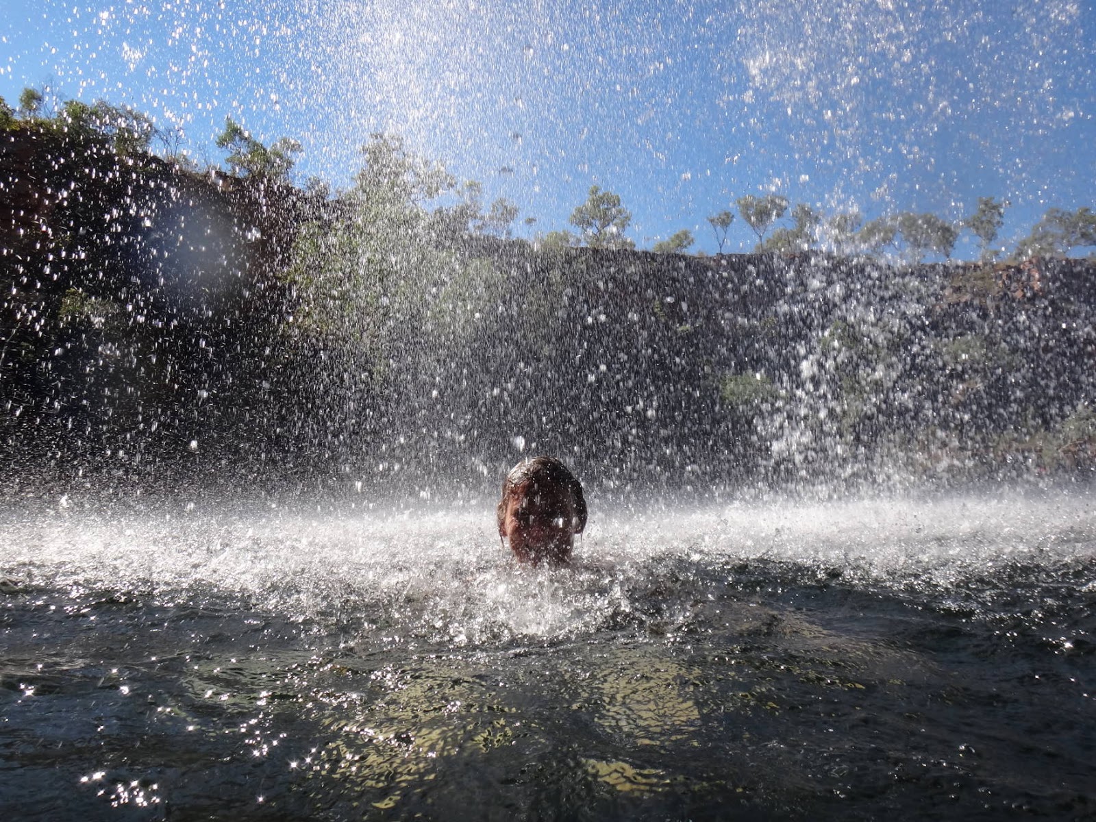
Kirsten getting a head massage under a waterfall in Manning Gorge. 

Geikie Gorge can only be accessed by boat, so we joined a tour. Note the high water mark during the wet season!

Grevillea Gorge on Charnley River Station has some amazing aboriginal rock art. We had to climb over rocks, through pandanus thickets and down two waterfalls to find it. 


Dillie Gorge at Charnley River....

.... and Wunnumurra Gorge on Mount Elizabeth Station.

Scrambling around to look for aboriginal rock art under overhangs is heaps of fun! 

The figures are mostly of Wandjina, the creator beings of the Dreaming for the Worrorra, Wunambal, and Ngarinyin people of the north-western and central Kimberley.


Driving in the Kimberley has many hazards. There are lots of cows, ....

...river crossings, ....

...dust, .... 

 ... bushfires (note all the birds chasing the escaping insects!) and ...

...huge trucks! We had to get off the road to avoid this one!

The diversity of fauna and flora is just amazing. The Yellow Kapok (Cochlospermum fraseri) was blooming everywhere and .....

... the Kimberley Rose (Brachychiton viscidulus).

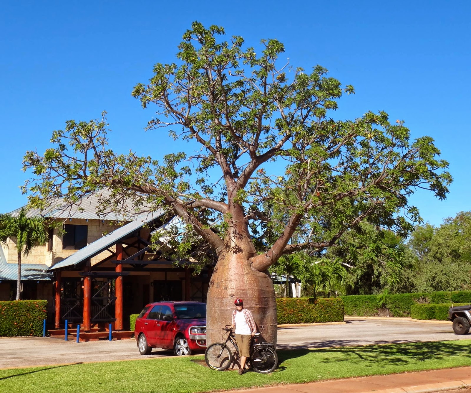
Some of the boabs are huge! They are deciduous and shed their leaves during the dry winter period. 

Below a sundew (Drosera sp.), a carnivorous plant in the process of digesting a dragon fly. 

Most creeks in the Kimberley have freshwater crocodiles (Crocodylus johnstoni), which are harmless to humans unless provoked. 


I think this goanna mis-identified itself!

A water monitor (Varanus mertensi) below....

... and a gecko (Gehyra dubia).

Having a shower on a campground in the Kimberley usually means having a shower with frogs! The common Green Tree Frog (Litoria caerulea) below, ...

... a Northern Giant Frog (Cyclorana australis), ...

... and a Northern Laughing Tree Frog (Litoria (Pengilleyia) rothii).

Below, a Banded Tree Snake (Boiga irregularis) hiding in a rock crevice in Galvans Gorge.
Reptile identification by Alex Dudley  - thanks Alex!

A constant companion in northern Australia is the Whistling Kite (Haliastur sphenurus). I love to hear their call every morning! Check it out on:
https://soundcloud.com/nature-sounds/whistling-kite-haliastur-sphenurus-1


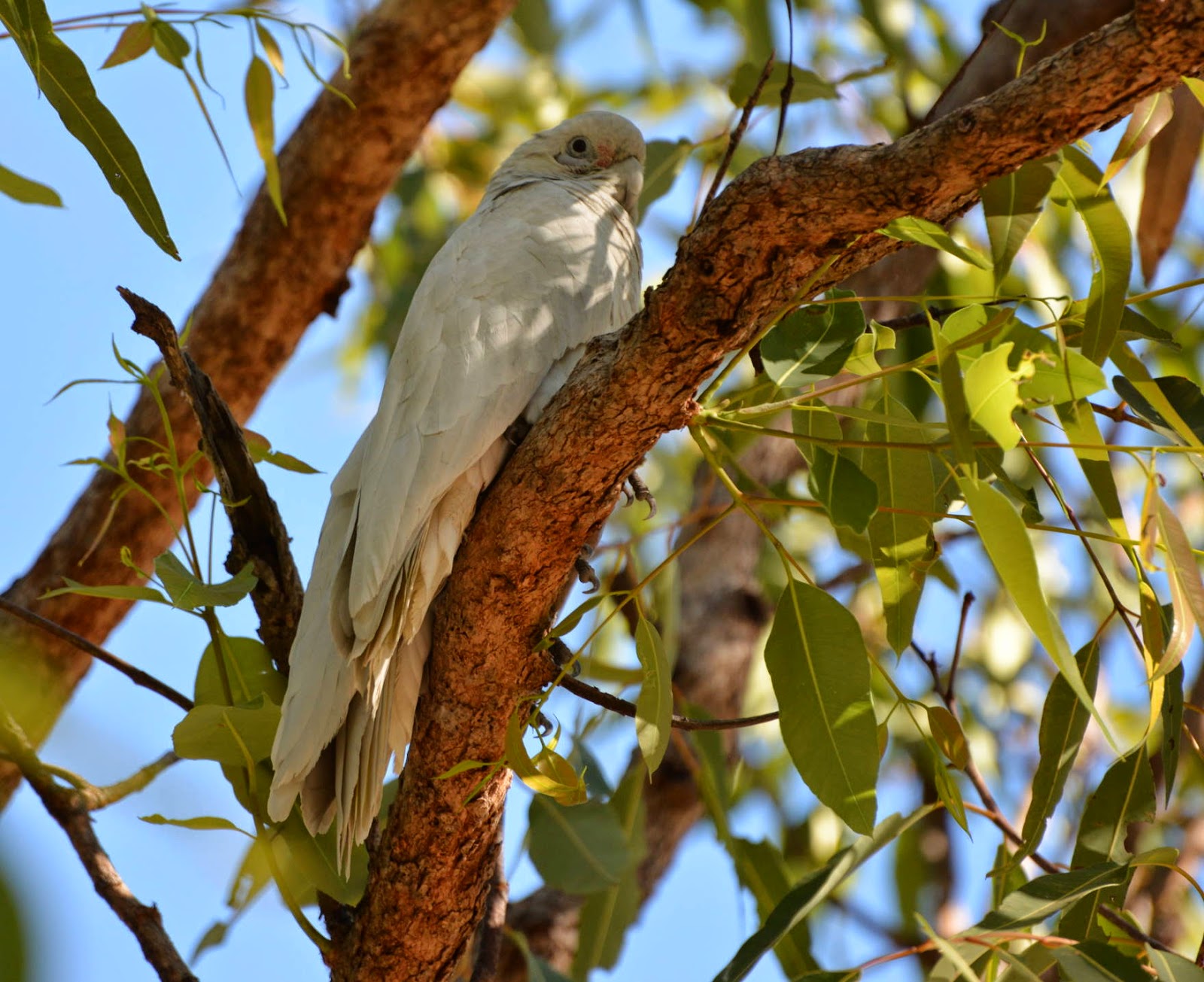
Other common birds include Little Corella (Cacatua sanguinea).....

 ... Rainbow Bee‐eater (Merops ornatus) and ...

... Double‐barred Finch (Taeniopygia bichenovii).

Friday 13 June 2014

Kimberley Coast

The busy time for tourism in Broome was only just starting and Kirsten found this amazing deal on the Internet. We had a whole house with our very own private swimming pool! And it was the same price as the small container shed we stayed at in Tom Price!

Sun Picture Garden claims to be the world's oldest outdoor cinema still operating (built in 1913). The deck chairs are really comfortable and you can bring your own beer (as long as you open it quietly after the lights go out)! 

Another of Broome's attractions are the dinosaur footprints at Gantheaume Point, dated as "Early Cretaceous" in age, i.e. approximately 130 million years old.

This amazing tree (Adansonia gregorii) is related to the Madagascan and African species known as baobabs. Here they are called boabs and they are everywhere!

Down-town Broome: street view and ....

... from the air.

The famous Cable Beach! It was named after the undersea telegraph cable, which was installed in 1889 and connected Broome via Singapore to England.

We didn't ride the camels, but of course we had to get the famous Cable Beach sunset shots!


I didn't want to get too close, they are a bit smelly!

Everybody is allowed on Cable Beach: people, cars, bicycles, dogs, horses, camels and even crocodiles!

The Kimberley coast is famous for its amazingly colourful and layered rocks.


The Kimberley is assumed to be the earliest settled part of Australia, i.e. about 41,000 years ago. White people, however, didn't settle in Broome until the 1880s when the oyster Pinctada maxima was discovered and harvested for mother of pearl. Once plastic was invented and used for buttons, combs etc, the industry changed to cultured pearl farming.

Once the Pinctada maxima stock was depleted in the shallows, Japanese divers dominated the industry and hundreds of them died, either from the bends or from drowning. The helmet is incredibly heavy and claustrophobic! I can't imagine walking on the ocean floor with this!


The only edible part of the oyster is the abductor muscle and of course I had to try it! Especially when it is served in four different ways and with Japanese flavours! It tasted a bit like watery squid.

The Kimberley coast boasts the second biggest tidal range in the world (up to 11m!). Most of the coast is inaccessible by road and is best appreciated from the air. So we decided to have our most expensive day yet and fly to Talbot Bay to have a look at the "horizontal falls". Interestingly, Broome airport is in the middle of town.

The coast displays an amazing array of colours, the red pindan cliffs, the white sand dunes and the blue water. Unfortunately, most places are not safe for swimming and snorkeling due to saltwater crocodiles.


Cape Leveque at the northern tip of the Dampier peninsula.

The geological make-up and layering of rocks in the Buccaneer Archipelago resulted in hundreds of islands with the tides rushing between them.


The two horizontal falls with the land-locked part on the right and Talbot Bay on the left.

The tour operators have a permanent pontoon in Talbot Bay with bar, jetty, toilets, jet-boats, shark cage (or rather people cage), helicopter landing pad and seaplane docking area. 

Landing on water is definitely fun and guess what! I got the copilot seat again! Kirsten prefers boats.

Sharks and crocodiles are attracted to the pontoon (and fed).

A tawny nurse shark below.

During the wet season, the pontoons are stored in Cyclone Creek (or cyclone-protected creek).

One of the horizontal falls below. The water level difference from one side to the other can be as much as 1.5m! We shot through it on a jet-boat several times. Quite rough and scary!

After seeing the Dampier peninsula from the air, we decided to explore it (as much as possible) by car. James Price Point is where a controversial gas plant was planned and then cancelled due to public outrage. It is a very important area for aboriginals, as well as environmentalists. Note the "no gas" sign on the left.


Cygnet Bay is a privately operated, third-generation pearl farm, which provides great camping and a fine-dining restaurant. 


Trevor the very curious local Olive Python. He loves to pop-out from the rafters and scare the tourists!


We couldn't get an aboriginal guided tour to go mud-crabbing or fishing, so we went for a stroll through the mangroves on our own. It's such an amazing habitat!


One-arm Point is an aboriginal community where tourists have to pay to drive in. They made us wear a fluorescent orange luna-park wrist band! Aboriginal culture and traditions are very much preserved and alive up here and the communities seem to function really well. It's refreshing to see!

Tourists are only allowed in certain areas, most of the town is for locals only.

Beagle Bay is another aboriginal community. The Sacred Heart Church was built in 1915 by German priest and locals. The interior, especially the altar, is decorated with mother of pearl shells.


Lombadina is yet another very cute town run by aboriginals.

The roof of this church is built of mangrove and paperbark.