Wednesday 11 January 2023

 2022 Hiking in the Swiss/French Alps

After weeks of cycling we left the bikes behind and packed our hiking gear. First stop: Leukerbad, a small mountain village in the Swiss Alps, surrounded by vertical cliffs. The place is famous for the therapeutic effect of the thermal water emanating from several springs. The first baths were built and used by the Romans!


We rented an apartment for a week with a balcony and a fabulous view!

A typical Swiss breakfast on the balcony every morning.....

... while watching the climbers on the Via Ferrata "Leukerbad Gemmi Daubenhorn".

The Via Ferrata is the longest in Switzerland (9km), takes 8 hours to complete, with 1,158m uphill climb and is rated extremely difficult. There is even a hanging bridge in a cave! Not for somebody with vertigo!

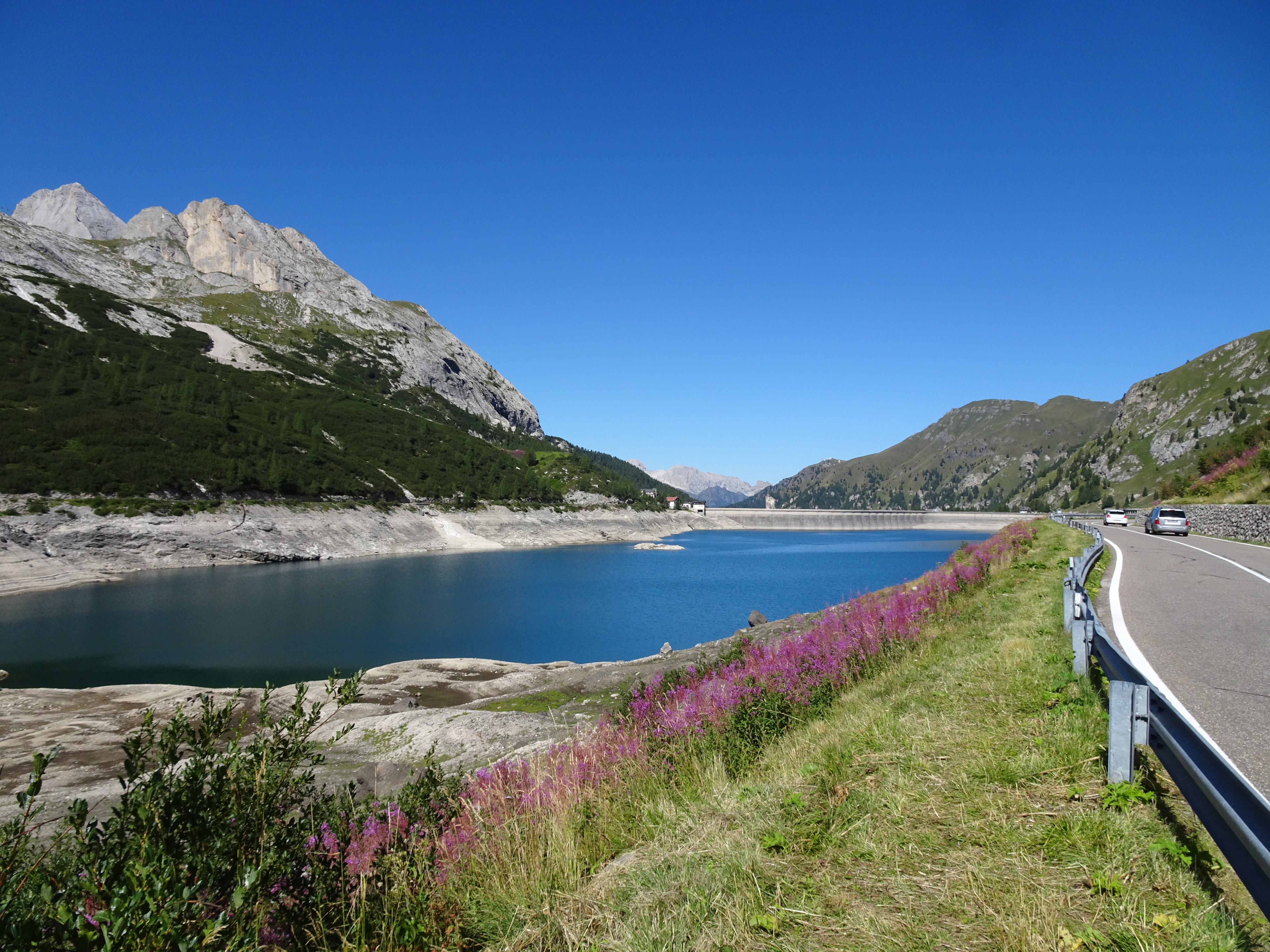
There are 65 springs in town, emitting 3,9 million litres daily of up to 51° C warm water. There is a large public thermal bath with fabulous facilities, as well as many private ones in hotels. The image above shows one of the springs with a bath from the old days. 


A 600-metre-long footbridge, which is suspended four metres above the river bed, passes through the imposing Dala Gorge, where some of the thermal springs are visible.

The Gemmi trail is an old mountain path leading over the Gemmi Pass into the Bernese Alps. It has been used for centuries by soldiers, pilgrims and traders. The trail is spectacularly carved into the rock face. I highlighted it in yellow below to make it more visible.


Gemmi Pass 2,270m

The trading route heading north into the Bernese Alps.

Lucky for people with bad knees: there is a cable car to go back down.

Here is an example of the Swiss attitude to risk in the mountains: you are responsible for yourself! We followed another old trading route from Leukerbad to Albinen that starts as an unsealed forest track, turns into a hiking trail and then turns into a sequence of 8 ladders going up 100m on a cliff! There was no requirement to wear a harness and clip in, no warnings and some of the ladders had rungs missing. 

After the second ladder, we decided it was getting too exposed and we turned around.

In the old days, the locals climbed these ladders with their goods to go to the markets! It appears they still don't mind the exposure.

We circumnavigated the cliff along the road and through tunnels. From the top we climbed back down to inspect the exit. You can see the road below where the climb starts. Definitely not for us!

The area has a large network of mountain biking and walking trails, all of them with spectacular views.... 

... and some great food along the way.


My friend Erna organised a few days in a B&B in the Valais (www.chaletdiognysos.ch). A charming place with lots of character, attention to detail and a personal touch. The owners, Sophie and Jérôme, have a lot of quirky ideas, are fantastic cooks and fabulous hosts! We even had a raclette in a wine barrel!

The Valais is famous for its "bisses", which are historic irrigation channels that deliver water from high mountain streams to pastures, fields, vineyards and orchards. Many bisses are still in use today and are carefully maintained. Some are in open ditches, some are timber structures along cliffs. 
Grand Bisse de Lens

View of the valley floor with the Rhone river. Lake of Geneva is around the corner to the right and the Mont Blanc massive is behind these mountains.

Some of the more exposed sections. In the old days there were no handrails or ropes!


Hiking to the water source for the Bisse du Tsittoret....

... with the traditional glass of Valais white wine, bread and cheese along the way with our hostess and tour guide Sophie.


Our third walk was along the Bisse du Ro, which was the most exposed one of the three.
The technique is still the same as in the old days. The timber irrigation channel is hanging from cantilevers that are wedged into the rock wall (with very crumbly rock!). The current method above and a section of the original channel below.

These walks are very diverse and interesting with a comfortable incline, fabulous views, ....

.. hanging bridges, ....

... places to worship and...

... even tunnels.

The last few days we spent in Chamonix in a small apartment with great views, a bakery across the road and a deli around the corner.


One of the best walks in Chamonix is the "Grand Balcon Sud" from La Flégère to Planpraz. It follows the contour lines with the full panorama view of the Mont Blanc massive for the entire walk. Just amazing!


During our 2 months in Europe (mid-July to mid-September) we got rained on for 10 minutes in total! Absolutely unprecedented! There were a few days with late-afternoon thunderstorms that we managed to avoid. Since we spent most of the time in the mountains we were not impacted by the heat waves and had a fabulous holiday.

Tuesday 10 January 2023

 2022 Dolomites

The Dolomites are a mountain range in north-eastern Italy, named after the French geologist Déodat de Dolomieu who first described the fossilised coral reefs and volcanoes that formed the geological layers. Due to shifts between continental plates, uplifting, folding and weathering, the Dolomites are a spectacular combination of rugged rocks and hilly, green mountain pastures.

We tried to combine as many cycling trails as possible to minimise riding on roads during the Italian holidays.


Starting point was the train station in Lavin, Switzerland. The first 3 days we cycled along the river Inn to prepare our muscles for the hillier terrain.

View of Guarda. The towns in the lower Engadine valley are all on the sunny side of the valley, not so flat for cycling!


Scuol, one of the last villages before the Austrian border.

Telfs, where the hotel provided a bike cleaning/repair station. Fabulous!


Lunch in Innsbruck. Above, the city's most famous symbol, the golden roof. Completed in 1500, the roof was decorated with 2,657 fire-gilded copper tiles for Emperor Maximilian I.

The menus in Austria are sometimes difficult to understand even if you speak German. Some desserts are called "palatschinken", but "schinken" is ham. Topfen has nothing to do with pots, fiaker (gulasch) is not a type of meat but a horse-drawn carriage. Tafelspitz is not the corner of a table but a meal with beef and vegetables. This one was delicious, but I cannot remember the name.

Our first serious incline: up the Wipptal Valley and over the Brenner Pass into Italy.

Every bit of shade was appreciated!

Small lake on top of Brenner pass, surrounded by highways, train tracks and a locomotive inter-change (due to different electrical systems in Austria/Italy).

The old train tracks on the Italian side were converted into a cycling trail with the abandoned train stations along the way.


This crazy fortress, the "Franzensfeste", was built between 1833 and 1838 by the Austrian Emperor to keep Napoleon's army out of Austria. It was never attacked. Mussolini and Hitler used it during WWII to hide gold reserves.


The Castle of Brunico is home to one of Reinhold Messner's Mountain Museums.


Riding up the Puster and then the Dobbiaco Valleys. Even though Italy is experiencing a drought, it is still so green!


Another pass climbed - Lago di Landro.

First glimpse of the rocky peaks.......

....and the famous Tre Cime di Lavaredo.

The long and exposed downhill ride to Cortina d'Ampezzo.


A well deserved drink in the centre of Cortina.


We decided to spend two nights in Cortina to have time for a hike. The Faloria cable car takes passengers from 1,224m to 2,134m, which is not as impressive as the ones to Cima Tofana (3,244m) on the other side of Cortina, which was surrounded by clouds.

Most walks up here are long, steep, rocky and very exposed!


Leaving Cortina with Tofana now visible.

Climbing to Passo Cibiana, our steepest road so far.

Churches in the Dolomites seem to always have a fountain with cold drinking water. So easy to find and refill!

Another day and another mountain pass: Passo Staulanza. This is what is so fantastic about the Alps: there is always a restaurant on top with great food!

The lake of Alleghe was created by a huge landslide in 1771 and the town was entirely submerged (and still there at the bottom of the lake). The new town was built along the shores of the lake.

Very comfortable start to the day along the Cordevole River.

La Fosina, a shop in Sottoguda, has been family run since 1923, carrying on the tradition of wrought iron craftmanship. The sculptures are stunning!


We locked up the bikes an took another cable car (Kirsten thinks it's my obsession!). This must be one of the steepest ones I have ever been on! From Malga Ciapela to Marmolada (3,343m).


We both felt dizzy and it was cold. Lucky we came prepared!

Half way to Passo Fedaia, we found this little hotel, which allowed us to break up the climb.

This is a typical Dolomite breakfast buffet: dominated by different combinations of chocolate, hazelnut and sugar....

.... and this is the evening version.

Last stretch to Passo Fedaia. The markings on the road were for the Giro d'Italia.


Lago di Fedaia with very low water levels.

Marmolada cable car station on the left and the collapsed glacier on the right.

Fassa Valley cycleway: clear water, gorgeous forests, off-road cycling and plenty of picnic spots.


The narrow valleys in the Dolomites are dotted with remote little towns on the sunny side of the hills.


We always tried to eat where the locals eat. This was one of our best meals: home-made ravioli, Carne Salada del Trentino (a local specialty) and a fresh mixed salad.

The road to this hill town was very busy, so when we saw two mountain bikers coming down this path, we thought it was a good idea. Lucky we don't mind pushing!

We stayed at the Grand Hotel Trento again - we just love the architecture!


Trento is apparently one of Italy's wealthiest and most prosperous cities with a colourful history and some amazing buildings! 

After riding through the bustling ski- and hiking-resort of Andalo, Molveno was much more appealing: a small town on a gorgeous lake with a relaxed atmosphere.

It seems, you cannot just have pre-dinner drinks in the Dolomites; they always come with salty nibbles, ...

... after which, there is not much room for dinner. Yes, that is a caprese salad in a wine glass! One has to adapt to what is available.

Val Rendena cycleway - it is amazing how much off-road cycling northern Italy is providing these days....

... even with purpose-built expensive bridges.

Whenever a town had a cable car going up to the nearest peak, I wanted to go up. There is no better way to spend the late afternoons than with a fabulous view, a small hike to relax the cycling muscles and to see the next day's route!

Peaks above Pinzolo

Another mountain pass...

.... more great vistas ....

....and more pre-dinner drinks. This is not a bad way to wait for your hotel room to be ready!

Val di Sole cycleway.

Our climb up to Passo del Tonale was on a very hot day and mostly on a busy road. Not the best part of our ride!

Passo del Tonale must be one of the least-impressive mountain passes I have ever seen! It is littered with tall, ugly buildings and the main road is super narrow and busy.
 
 The WWI memorial and its ossuary is gigantic!

Ponte di Legno

Fancy having a cycling trail go through your house!

Descending into Tirano was like entering an oven! The heat and traffic was unbearable, so we caught the next Bernina Express, back to the Swiss Alps.

The famous 360 degree turn of the Bernina Express. 

Lago di Poschiavo, along the slow climb to the Bernina Pass.

From Pontresina, we decided to spend a day hiking up to the Morteratsch glacier. This photo shows where the tongue of the glacier was in 1970, now it is barely visible on the image. A university study revealed that the glaciers in Switzerland lost 50% of their volume since the 1950s and 6% in the summer of 2022 alone!

The current glacier mouth with melt water gushing out.

Swiss trains seem to cater for a lot of cyclists these days. Impressive!