We decided to try our first section of it over 5 days. Lithgow and Musswellbrook are accessible by train, so it seemed like an ideal short trip. The trail leads through Ben Bullen State Forest, Gardens of Stone National Park, Wollemi National Park, Nullo Mountain State Forest and many private properties. The majority of the trail is not accessible to motorised vehicles and there are many locked gates along the way. As a consequence, we had every campsite to ourselves over the Easter holidays!

The trail sign - they are sometimes hard to spot and it is important to have the map and a GPS.


Our first steep ascent just north of Lithgow, heading towards Wolgan Gap.

View into the Wolgan Valley from the trail, which follows the edge of the escarpment.


Descending to Baal Bone Creek. Even the downhill is too steep and slippery to ride! I am not sure how horses manage not to slip on this.

There is evidence of recent heavy rains everywhere and we had to dodge many puddles.

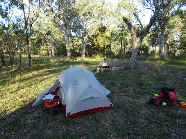
Camping just below Baal Bone Gap. Unfortunately, there was no water but we managed to get some the next morning from the pumping station at the gap.


Descending through Gardens of Stone National Park into the Capertee Valley. At Glen Davis we had a long break to escape from the heat. The campground/community centre provides free drinking water, shaded picnic tables, flushing toilets and even showers!


Shortly before sunset we pedaled another 12 km to Glen Alice, where we camped next to Umbiella creek with an amazing view of the red escarpment. Yet again, the RFS/community hall provides drinking water, picnic tables and flushing toilets.


Riding north along the Upper Nile Road was an easy start to the day.... until the trail followed a firetrail uphill! An ascent of 500m over 2.5 kms.

Kirsten at the beginning of the toughest ascent yet. Some sections were so steep and slippery, it took both of us to push one bicycle. It took us 3 hours to climb the 500 m in elevation.


Taking photographs of the gorgeous landscape was a welcome break.

The view from Grassy Mountain towards Capertee Valley where we came from.

The small shelter at Grassy Mountain provided welcome shade and drinking water. We stopped for the hottest part of the day and cooked many cups of broth, tea and hot chocolate to re-hydrate and re-energise.


The afternoon was spent riding through the beautiful Wollemi National Park. This section of the trail was amazing to ride, slightly undulating terrain, soft surfaces and stunning trees! Another campsite all to ourselves at Cudgegong River.


An easy day of riding through State Forest and private properties and (apparently) within a couple of kilometres of the famous patch of Wollemi Pines (which is not a pine but an Araucaria). The oldest fossil of the Wollemi Pine has been dated to 200 million years ago.

We decided to stop early at Sandy Camp Hut and camp for the night. We loved the remote wilderness and could not face the Easter crowds in the valley and busy roads.


Time to wash some of the sweaty gear!


During the early-morning descent into the Myrtle Valley our track turned into a wet paddock and left us splattered in cow poo!

Heading into the Widden Valley towards sealed roads, civilisation and busy Easter traffic.
Another fabulous bike ride - if one doesn't mind a bit of pushing and lifting the gear over locked gates!