
Our first detour along the way north: Lakefield National Park. In the dry season it contains many lagoons, rivers, water holes and swamps. In the wet season it's just one big bog!
Here's our first magnetic termite mound - or rather castle! It is built by the species Amitermes laurensis and the mounds tend to be aligned in a north to south direction. Why? Well, there are many theories, but the most modern one is that it's about temperature control in flood-prone areas. For anybody who's interested, there is an excellent fact-sheet on the internet by the QLD museum.


One of the lagoons containing many birds, plants and some crocodiles.

A white lotus in a lagoon...

... and a red one as well.

A magpie goose....

.... and my first sighting of a Jabiru in the wild!

There is a crocodile warning sign at every patch of water....
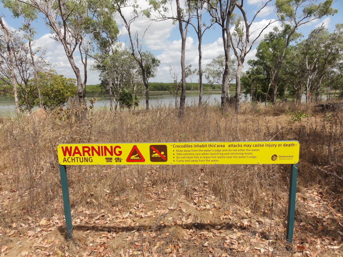
.... but they are obviously justified!! We thought this one was a fresh-water crocodile. However, we were later told by the ranger that it is a small salty (which seem to have a greater appetite for humans than the freshies). It definitely kept an eye on us the whole time we were there!

What a gorgeous spot to camp on the Hann River!!

Lucky the site is approximately 2m above water. We've been told that salties don't climb rock faces....

Macaroni Boscaiola - not a bad effort on a camping stove!

How is this for a view out of the bedroom window?? The big tent is certainly a luxury well appreciated.

One of the many water crossings along the way.

There are so many small lizards and frogs in the park.

I wonder where all the reptiles go when the dry areas are inundated during the wet season?

Iron Range National Park - our camp in the rainforest. It was a very noisy night!! Nocturnal birds, mammals, bats and hundreds of frogs!! We even found a cuscus and a striped possum while spot-lighting!! Kirsten couldn't sleep all night, but I loved it!!


The beach at Portland Roads, a small community north of Lockhart River.


The rainforest contains many colourful and interesting looking fruit and seed-pods.

Chilli Beach, a very popular camping spot. No swimming though, due to saltwater crocodiles patrolling the beaches!

The Old Telegraph Track is another famous 4WD playground. Some of the creek crossings are impossible to negotiate without potential damage to the car and apparently 56 cars have been written off within the last 6 months! Most crossings, however, have what they call a "chicken run", i.e. a by-pass track. We did most of the Telegraph Track except for Gunshot Creek, Nolan's Brook and the Jardine River.

Our first hairy crossing was Palm Creek, which attracted a good number of spectators and people waiting to go through. Locals told us that with the current track conditions, if you can do Palm Creek, you can do it all! I wouldn't have dared, but Kirsten decided to have a go. Here she is, deciding where to put the wheels.....


There are only two locations on the whole of Cape York where swimming is crocodile-safe: Fruit Bat Falls and Elliot Falls, because the crocs are assumed not to climb the waterfalls. Kirsten cooling off with a drink at Fruit Bat Falls (and washing her clothes at the same time).


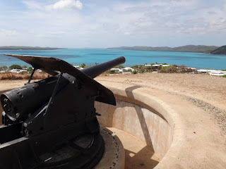
Thursday Island below, which is Australia's northernmost town and the administrative centre for the area.


Between the 1870s and WWII the pearl-shell industry attracted hundreds of schooners and mostly Japanese divers. Over a thousand divers are known to have died from the "bends", drowning or shark attacks.


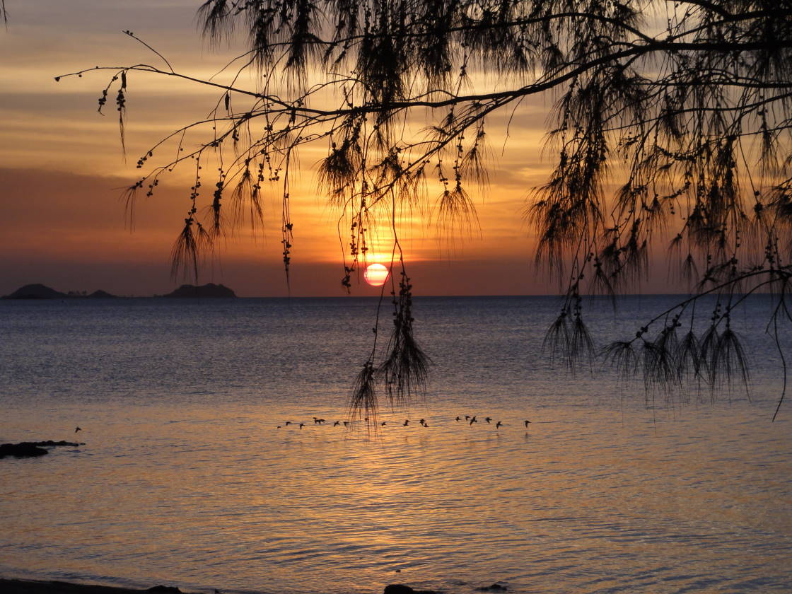
Sunset at Loyalty Beach in Seisia - a great spot to camp!

The Frangipani are pink up here.


.. then washed and processed into Alumina to be shipped off to the Gladstone smelter. Note how everything is coated in red dust!


Instead of taking the sealed road to Cairns, we drove out to Cape Melville National Park and then south along the coastal Starcke and Bloomfield 4WD tracks.

The campground we booked was located between the ocean and a tidal creek - not ideal when you don't want crocodiles thrashing through your tent in the middle of the night. So we drove further up the beach where we found a group of Wongai trees with a perfect little sandy circle in the middle. Our tent is just behind the car in the middle of the trees, well out of sun, wind and crocodile paths.


Some of the locals.....they all seemed to be posing for the camera!!


... below she's daring the crossing (video might not work on iPads)...
.... and at the other end with the detached bash-plate and a dented number plate.

Here are some more action shots of other cars during creek crossings.


Most sensible people take the ferry across the Jardine River, but some people still attempt the crossing through crocodile infested water. Here's the northern exit where a car got stuck all night, then towed to Bamaga and written off (the inside of the car was covered in mud all the way up to the glove box!).

The Jardine Ferry.

Gorgeous carnivorous pitcher plants along the creeks.


The next day at Elliot Falls. The water was so clear and refreshing!


Torres Strait and the Tip
We made it to the tip - 1,000 km from Cairns! It doesn't feel like the northern end of Australia though, because there are so many islands.

The Torres Strait Islands have a rich history of early explorers, piloting of the shipping channels, a pearl-shell industry and as WWII outposts.


As a result of the island's history, the population is a mix of Torres Strait Islanders, Aborigines, Europeans, Papuans, Indians, Chinese, Japanese, etc.

Between the 1870s and WWII the pearl-shell industry attracted hundreds of schooners and mostly Japanese divers. Over a thousand divers are known to have died from the "bends", drowning or shark attacks.

During WWII Thursday and Horn Islands were used to defend Australia against the Japanese.


Most goods are brought in on ships from as far away as Cairns and then ferried between the islands. Here's the passenger ferry between Thursday and Horn Islands.

Sunset at Loyalty Beach in Seisia - a great spot to camp!
The Frangipani are pink up here.

And here is the local lunch. If it wasn't so hairy, I might have tried...

On the way south we visited Weipa and participated in a tour of the Bauxite mine. Below shows how the Bauxite is strip-mined, loaded onto huge trucks, ..

.. then washed and processed into Alumina to be shipped off to the Gladstone smelter. Note how everything is coated in red dust!

Weipa was hot, dusty, windy and the campground like a can of sardines. The visitor information told us to visit the gorgeous beach at Pennefather. After a 90 km drive through burning bushland, we found a beach covered in rubbish - supposedly washed in from Indonesia. I guess I won't be applying for a job in Weipa any time soon.


Instead of taking the sealed road to Cairns, we drove out to Cape Melville National Park and then south along the coastal Starcke and Bloomfield 4WD tracks.

The campground we booked was located between the ocean and a tidal creek - not ideal when you don't want crocodiles thrashing through your tent in the middle of the night. So we drove further up the beach where we found a group of Wongai trees with a perfect little sandy circle in the middle. Our tent is just behind the car in the middle of the trees, well out of sun, wind and crocodile paths.

The track to Cape Melville was very deep and soft sand. The car below is not us!

Kirsten is moving mountains while I fill up the water bottles in a fresh water stream.

From soft sand on the Cape to bulldust holes on the Starcke Track. The fine dust particles are like flour and conceal holes and obstacles in the road. When driving through it, the dust gets airborne and gets into everything! Our car will never be clean again, inside or outside.

Our travelling speed for some sections was <5km/h. We took 6.5 hours to do 100 km!!

Some of the locals.....they all seemed to be posing for the camera!!


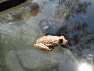
I have no idea how this little guy ended up on our windscreen while driving! Judging by the yellow/black thighs and the red upper half of the eye, it's a Litoria rothii.

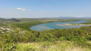
Cooktown on the Endeavour River is where James Cook repaired his ship in 1770 after running aground on the Great Barrier Reef. It's a gorgeous little town surrounded by mangroves, eucalypt scrub and rainforest.

Along the coast north of Cairns....

... and finally Cairns.

Summary of "issues" with the car:
- broken windscreen (car with camper going too fast)
- broken tail light (truck cutting corners at a petrol station)
- voltage loss on fridge (ARB did the wiring wrong)
- shredded air conditioning belt
- leaking break fluid
- leaking differential oil through air compressor
- lost bash plate (self inflicted)
- dented number plate
- lost tow bar cover