Purnululu is the aboriginal name for the layered sandstone formations. The name of the National Park has been recently changed because nobody seems to know why it was called Bungle Bungle in 1983, when it was "discovered" by a film crew.
Only 20% of the park contains the famous bee-hive domes, the rest of the range is an equally beautiful maze of strange rock formations, red cliffs, narrow gorges and spinifex plains.
If anybody is interested, here is the reason for the two colours of the layers. The dark layers have a higher clay content and hold the moisture better. This allows them to support cyanobacteria growing on the surface and thus protecting the outer layer from erosion. The lighter coloured layers have less clay, are more porous and dry out quickly. Therefore, cyanobacteria cannot grow here, which leads to surface erosion and oxidisation of the iron.
By the way, the photo below has not been enhanced with photoshop. The landscape really is that colourful!
Cathedral gorge is a massive sandstone overhang underneath a waterfall. Imagine the force of the water digging out this cavity!
Echidna Chasm is very hard to photograph due to its size and contrast in light. Note the little blob standing in the middle - that's me.
We did our longest one-day walk ever: 21.2 km to Piccaninny Gorge and back. After the first 5 km there is nobody else!
The "trail" was the dry creek bed, which comprised rock, gravel or sand.
Me, having a rest at Black Rock Pool (with very sore feet!).
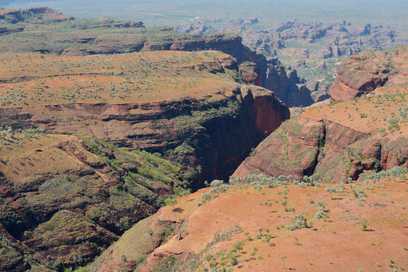
The beautiful red cliffs of Piccaninny Gorge.
This was definitely on my bucket list: a helicopter flight over Purnululu. Again, the helicopter had no doors and it was a very windy day. What an amazing flight! Definitely one of the highlights of the trip! Below some of the beautiful patterns and colours of the rock formations.
Note the fishbone look of the road. The graders create dirt ditches off the road, so the water drains during the wet season.
Unfortunately the cane toad has arrived in WA! It was depressing to see the high number of toads and low numbers of quolls, goannas and snakes etc. in the eastern Kimberley compared to the western Kimberley, where the toad hasn't arrived yet (but is expected during the next wet season).
Between April and July 2014 visitors collected 40,000 cane toads on one campground in Purnululu!
Our campsite was regularly visited by chatty groups of double-barred finches.
This complicated structure was created by a bower bird. In NSW they collect blue things, up here they seem to like white.