Thursday 23 August 2012

Alice Springs to Birdsville (via Simpson Desert)

We did it!! We crossed the Simpson Desert with over 1100 sand dunes. What a spectacular trip!! Both vehicles, as well as drivers and passengers performed extremely well!! Thanks team!!

Our two fantastic pilots on top of Big Red. We all had a go, but these two did the tough stuff!

Below is a Google Earth image of the Simpson Desert sand dunes. Isn't it beautiful??

Our route is shown in orange.

One of the first stops was at Mac Clark Conservation Reserve to see one of Australia's rarest trees, the Waddi Tree (Acacia peuce). The purple rocks in the foreground are gibbers.

Witjira National Park is adjacent to the Simpson Desert and was created to protect the over 80 natural springs around Dalhousie. Only one of the springs is available for swimming at 43 degrees (the others are too hot or protected). There are six different fish species in these springs!!

The Dalhousie homestead ruins are from an era when this area was thought to be ideal for pastoralism - they didn't have many good years until it was abandoned in the 1900s. The date palms were imported by Afghan cameleers.

The French line was compacted by all the vehicles heading to Birdsville for the races and was pretty busy. We decided to stay away from the crowds and go along the WAA line, which is famous for soft, red and absolutely gorgeous sand dunes.

Below is a video of what it was like to drive along the WAA line (it doesn't seem to work on iPads):


What a good looking car with the flag! Thanks boys for the present!!


In regards to food we certainly traveled in style. Breakfasts ranged from scrambled eggs and smoked salmon, to strawberry pancakes, to fresh fruit and cereal. Here's Kirsten having her morning coffee with a gorgeous view!

All of us having breakfast. The serenity....

Lunch was usually crackers, tomatoes and cheese, followed later on by sunset drinks on top of a sand dune.

And for dinner a BBQ cooked over a camp fire by our very own hobby chef, Cameron!!


I used the Bedouin method of "prewashing" greasy dishes in sand, which helps preserve water. It works even better under friendly supervision by Sue.


What's the most environmental way to go to the toilet when there isn't one?? You dig a 30-50cm hole (preferably on a slope so you get a nice view and it's more comfortable to sit) and after you finished you burn your toilet paper in the hole (so it doesn't end up all over the landscape if animals dig it up) and then close it.
Note: when you're in clay country you'll need a spade rather than a trowel!

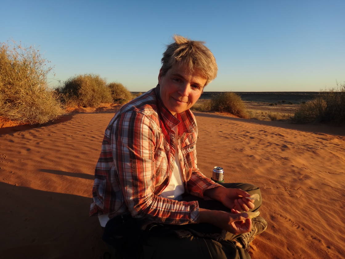
What about showers?? Well, sometimes there's a bore providing hot water, sometimes a sponge and a tub of cold water will do and somtimes you just don't bother. Here's Kirsten on day 5 without washing her hair.

The eastern part of the Simpson Desert contains large salt lakes. Here's Sue getting a work-out by crossing a salt lake on foot.

The salt lakes certainly improve the already photogenic landscape.....

.... especially when the moon is rising over them!!

Even though the Simpson is one of the driest places in Australia, there was so much vegetation and so many different colours! Some of the most spectacular flowers below:
Poached egg daisies (Polycalymma stuartii)

Desert Parsnip (Trachymene glaucifolia)

Regal birdflower (Crotalaria cunninghamii

Mistletoe

I have no idea what this one is, but I was very impressed with its tenacity.

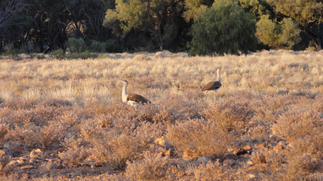
Some of the fauna we spotted along the way:
Feral camel

Australian Bustard

Nankeen Kestrel

Poeppel Corner is where the Northern Territory, Queensland and South Australia meet.

On the QAA line heading for big red.

For people who have never heard of big red: it's the last sand dune before Birdsville when heading east and it's also the biggest one! To drive up big red seems to be some "rite of passage" for true 4WD'ers or maybe it's just a way for hoons to wreck their cars... It was definitely fun to watch though!
The 4WD playground on top of big red.....

... and the ascent from the east.

Here's our energetic tour guide Laurelle on the very top of big red. Check out her website for DIY tours out of Alice (http://www.diytourguide.com.au/). 

Lake Nappanerica - quite a site when coming over big red!

Pumping up the tyres after a week on sand with 18psi.

I was very sad to leave the desert!! I just wanted to turn around and do it again!!

The last glimpse before heading to Birdsville....

The plan was to arrive at Birdsville to see the famous Birdsville races. Due to car troubles in Alice Springs and too much fun in the desert, we missed the races by one day. Just as well, below is the Birdsville Hotel covered in tinnies and drunks. Apparently there were 6000-8000 people in Birdsville and 80% had left by the time we arrived. It was still a shock to see so many people in the middle of nowhere!

Our last dinner with our Simpson desert adventure buddies with an appropriately named wine.

Our last camp together - two nights at the (now deserted) Birdsville caravan park next to the Billabong.

This is the Simpson Desert Vehicle Recovery Truck (a 1979 German army supply truck). Apparently, depending on location, a recovery can cost up to $10k!!

Summary on consumption over 10 days and 1,100kms: 
  • We had 156 litres of Diesel for our car and used 88 litres from Mount Dare to Birdsville (which gives us a usage of 13.5 litres/100km - which is not too bad for soft sand).
  • For the two of us we brought 60 litres of water and used only a third. 
  • In total we drank approximately 14 bottles of wine, 2 bottles of whiskey and a slab of beer
  • Additionally, we devoured the content of one 60 ltr fridge and two large eskies.

Saturday 11 August 2012

Sydney to Alice Springs

Balranald
Three months ago (to the day!) we came through Balranald on our way to Sydney. Since then the flood waters have receded a little and it is amazing to see what effect on the environment they have! The two photographs below show the same area 3 months ago and now.


Lake Mungo
The first stop along our route to the Simpson desert is Mungo National Park, which forms part of the Willandra Lakes World Heritage Area. Lake Mungo is one of 13 ancient (now dry) lakes where the oldest human bones in Australia and the oldest human cremation were discovered.

View of the lake from the western side.

The eastern side of the lake has a crescent shaped "lunette" of sand which moves east >1m per year due to prevailing westerly winds. The layers exposed by the missing dune slowly erode and expose historic aboriginal camp sites, tools and bones. This is how Mungo Lady (estimated to be between 40,000 and 68,000 years old) and Mungo Man were discovered.

Since we are now travelling in style (by car rather than bicycle), we can indulge in luxuries while watching the sunset.


The eroded layers form some interesting patterns.

Note the sand blowing off the highest point of the dune - it was really moving when we were there! We both had our left ears filled with sand while climbing it!

Below is a replica of 20,000 year old aboriginal footprints (the originals have been reburied in sand to preserve them). The footprints in the middle seem to be missing the left foot....

Kirsten is cooking breakfast while trying to fend off the naughty apostlebirds.

We brought our down doona (another luxury we couldn't have on the bike rides), which makes our tent very warm and cosy! Double layer of therma-rest, flannel sheets, two pillows each and a down sleeping bag for when it gets really cold. Who needs a motel room??

Coober Pedy
The name Coober Pedy is derived from the aboriginal words for "white man in a hole". What a perfect name! Apparently opals were first found here in 1915 and there is still lots more to be dug out, supplying 80% of the world's opals. The town is riddled with holes and mounds and most people live underground. 


Uluru & Kata Tjuta
The rock is always amazing, especially at sunset! No need for words....


The Olgas (Kata tjuta) from a distance....

... and up close.


Some notes on flora and fauna
It is amazing how there is always something blooming!! The different ecosystems are just gorgeous! In regards to fauna, here's the list in sequence of high to low numbers of sightings: cows, goats, emus, roos, sheep, cats, foxes, camels and a dingo. At least the natives didn't all end up at the end of the list.

Below two road trains loaded with feral camels on their way to the abattoir in Peterborough.  


Dingo checking out the cars for a free meal.

Some of the flora...


Just before Alice Springs we had our first car trouble: air conditioning belt. Lucky it's not summer!

Alice Springs
View of Alice Springs from ANZAC hill. 

We were lucky to arrive in Alice Springs on the day of the "Henley-on-Todd" Regatta, which is a sailing, rowing and surf rescue competition in the dry river bed of the Todd River. It has been a yearly event for 51 years and had to be cancelled only once due to water in the river.

The "finale" was a gladiator-style battle between the three big ships, powered by four wheel drives and armed with flour mortars and high powered water cannons.

East MacDonnell Ranges
The ranges east of Alice Springs are much less visited by tourists but just as spectacular! I can never get enough of those white ghost gums (Corymbia papuana) clinging onto red cliffs and the old River Red Gums (Eucalyptus camaldulensis) along the watercourses! The gorges are beautiful and usually contain permanent water and sometimes provide habitat for colonies of the threatened Black-footed Rock-wallaby. 

Trephina Gorge


Ghost gums.. 


...and a very artistic shot by Kirsten!

The bark of a River Red Gum.

The Trephina Panorama walk was just spectacular with wildflowers everywhere.

Black-footed Rock-wallaby at John Hayes Rockhole

The "chain of ponds" in the Trephina Gorge Nature Park.

Arltunga Historical Reserve: Arltunga was a gold mining town of up to 300 people between 1887 and 1913. The miners could only reach the area by walking 600km from the Oodnadatta railhead. Many of the buildings have been restored and some of the machinery from the battery and cyanide works can still be seen.

Health & safety laws must be pretty relaxed in the Northern Territories. Some of the old mine shafts are accessible and interconnected.

Zebra Finch in the wild (as well as hundreds of budgerigars flying in formation).

A bearded dragon trying to be invisible.

The unsealed road to Ruby Gap is for 4WD only and was a great trial run to get acquainted with the abilities of our car (and the drivers!). Ruby gap is where David Lindsay found what he thought were rubies, which started a "ruby rush", only to discover that the stones were merely worthless garnets. The dry river bed is still covered in millions of small "rubies".


River crossing on the way to N'Dhala Gorge.


Once a jolly swagman camped by a billabong
 Under the shade of a coolibah tree,
 And he sang as he watched and waited till his billy boiled:
 "You'll come a-waltzing Matilda, with me."