Wednesday 23 April 2014

Via Stirling Range to Albany

The Holland Track is a 350 km 4WD track from Kalgoorlie to Hyden leading through gorgeous woodland dominated by Gimlets (Eucalyptus salubris). It took three days to complete with two nights of bush camping.

Some Gimlets are almost chocolate coloured!

My favourite afternoon past-time: plotting a route while drinking a beer. 

This cockroach was 5cm long! And what amazing colours... 

Who says I can't catch a wave! Some silly person actually left a surfboard at Wave Rock.

We have now climbed so many granite boulders and they are still beautiful and unique.

Mulka's Cave in the Humps contains some of WA's most significant aboriginal art. 

The rugged peaks of the Stirling Range abruptly rise from the surrounding landscape and are a hotspot for biodiversity. Eighty flora species are only found here!

Bluff Knoll (1,095 m) is the highest peak, very steep and a popular bushwalk. Lucky we started early! We took a long time to come down because we had to let everybody pass who was going up (the swiss alpine etiquette).

We got up at 4 am to watch the sunrise! It was only 12 degrees and we waited for hours for the sun to appear behind the clouds!

The day we climbed it, the top was covered in clouds and ....

.... we only got a 30 second glimpse of the parking lot below. At least it made the 600 m drop less scary.

The climate on top is alpine and the vegetation is very different from lower parts of the range. The fact that everything was covered in dew made it even more interesting! 


Sunset from our camp with the western part of the range in the background.

Below Bluff Knoll seen from Mount Trio (856m).

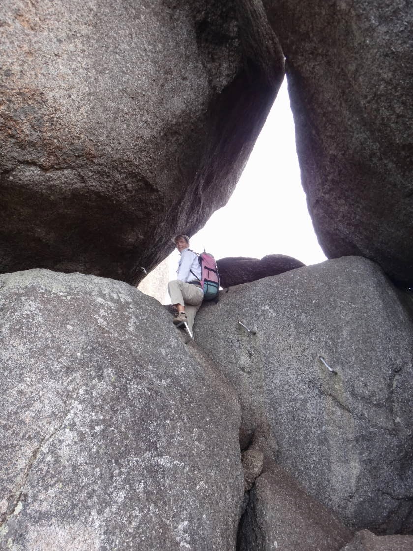
Just south of the Stirling Range is Porongurup National Park, where massive ancient granite domes rise up to 670 metres. Here is me climbing up to the skywalk at Castle Rock.


The lower parts of the park are covered in gorgeous karri forests.

After the Easter crowds have left, we are back on the coast. Albany harbour....

.... and Torndirrup National Park.

Monday 14 April 2014

Kalgoorlie

On the way to Kalgoorlie we camped at Peak Charles National park. After the busy Cape Le Grand National Park we loved the solitude!

The top of Peak Charles was too scary to climb, but the view from just below the summit wasn't bad either. The area forms part of the Great Western Woodlands, a 16 million hectare woodland/heath interspersed with salt lakes. It apparently contains 20% of all Australian flora species!


At Kalgoorlie we visited my friend Leana and did a tour of the KCGM mine. Gold was discovered here in 1893 and the Super Pit now produces over 22 tonnes/year. One tonne of rock contains only an average of 2.5 grams of gold. That's a lot of rock to move, crush and process!

The pit is over 600 metres deep, approx. 3 km long and 1 km wide!


The size of everything is staggering! Every one of these trucks costs $17 million and each tyre $38,000! Haha, no wonder they like women driving them!
Note the little white dots on the parking lot are "normal" sized cars.

Kirsten looks good as a miner!

Kalgoorlie town centre below. The town has gorgeous old buildings and nice pubs (with topless bar-maids). Due to the proximity of the Super Pit, the whole town shakes every time they blast a new section of rock (which happens at least twice a day!).
 

Nullarbor Plain

Fowlers Bay, our last stop before the Nullarbor, is being taken over by big white sand dunes. A gorgeous spot, but not a sensible real-estate investment.

The Nullarbor Plain is approximately 200,000 square kilometres and is a 1,000 km drive to cross. The area is riddled with sink holes and caves, some of them containing water. Most of the caves are a long way from the main road on a dirt track through very barren landscape!

Here's one of the Murrawijinie Caves.....

 .... and the Bunda Cliffs along the Nullarbor coast. 

From Balladonia (where most of the US Skylab fell out of the sky in 1979) we turned south to Cape Arid National Park. The track was very rough at times with corrugations, rocks, sand and dried-up mud where people got bogged. A 200 km drive took over 8 hours!


Of course we had to climb Mount Ragged along the way!


Israelite Bay was a significant telegraph station in the early 1900s, now there is nothing but sand and the ruin of the old building! Note the mail box at the front facade of the building!
 

We camped at Thomas River and did some of the walks along the coast. Gorgeous!


The sand is very fine and white and the water is very clear. 
 

Cape Le Grand National Park is not to be missed! Here's Frenchman Peak with its giant arch. From the top there is a fantastic view of the Recherche Archipelago.


A 15 km bush walk connects all the peaks and beaches through the park - climb every hill and swim at every beach!

The weather was just perfect with hot days and cool nights. Due to the campsite being crowded, we escaped to a secluded spot for breakfast.

The French Bakery in Esperance makes the best bee-stings we ever had!

Hellfire Bay is unbelievably pretty! The water is so clear!

Below are some images of the southern WA vegetation. The flora is so different from anywhere else in Australia!