This is the most remote part of the trail. Yet again, the weather was fantastic for riding! We first headed over Yarrah Vale Gorge (which should be called Yarra Vale Hill!), then into the next range and into Warren Gorge. This area is famous for being one of the last refuges for Yellow-footed Rock-wallabies, but we didn't see any (too many tourists in cars and wrong time of day). After a quick lunch we rode around the Ragless Range and into Willochra Plain. The map says to camp at Buckaringa North, but we decided to take a few kms off the next day and keep going. The forecast was for thunderstorms and we decided to bush camp near the Kanyaka Waterhole.
Climbing up Yarra Vale Gorge - haha, the "gorge' was much lower.

Warren Gorge - very beautiful with the red rocks!

Hugh Proby's grave. The poor guy drowned here in a flash-flood. Fancy drowning in the desert!

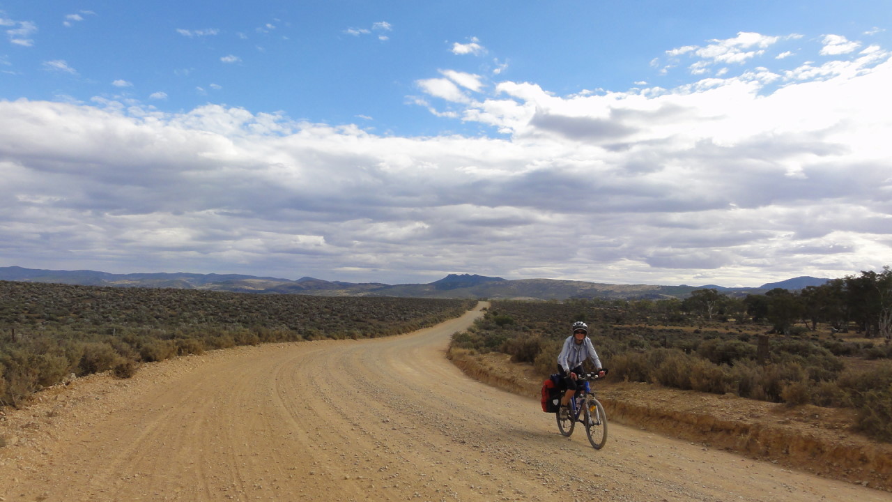
Long roads - but nice and flat!
Permanent water at Wilochra Creek.

The town that never was! They surveyed, decided to build a railway, sold land, started building the pub - and changed their mind!!


Thunderstorms in the south.

Our first proper camping night. No showers, no toilet, lots of dust and almost out of water....


Day 17: Kanyaka Waterhole to Hawker (53 kms)
This was supposed to be an easy day, but unfortunately some farmer locked his gates and the Mawson trail had to be detoured, which added a few kilometres. The first 20 kms we spent riding towards Craddock with a strong head-wind, which was absolutely exhausting. It didn't help that we didn't have enough water to have a proper breakfast! At the very cute Craddock Pub we refilled with coffee, water, chocolate and two delicious hot cross buns from the owner! The next 25 kms to Hawker were with the wind, which changed our average speed from 8 km/h to 29 km/h!
Kanyaka Waterhole and Death Rock (don't know where the name comes from!)

The Pub in Craddock - a very welcome sight!

More long flat roads, but this time with the wind!


Mawson Trail detour - added about 10 kms to the trip.

Hawker town centre.


Day 18: Hawker to Merna Mora Station (59 kms)
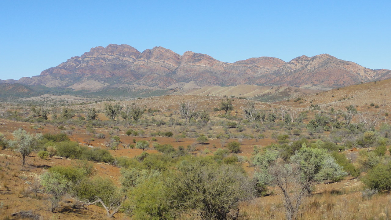
This section of the trail leads along the western side of the Elder Range, which is absolutely stunning! After climbing a small gap the descent was so steep and slippery (gravel) that we had to walk down. The track surface was generally very rough and demanded a lot of concentration. I still managed to get puncture no. 16 by getting stabbed by a bush! The last few kms were on a sealed road to Merna Mora Station, which is an active cattle/sheep station that provides tourist accommodation in the shearer's quarters.
Beautifully smooth clay soil - perfect for riding (when it's dry!).

Kirsten is trying to answer a client's request and read her drawings on the notebook while the panier is serving as a mouse-pad. Interesting office....

Climbing the small gap at the southern end of the Elder Range.

Close encounter with a shrub. The inner tube "exploded" and had to be replaced. The tyre was fine with a bit of gaff tape on the inside.

Gorgeous location for a bit of bike maintenance.

Rough surface all day!

Elder Range.


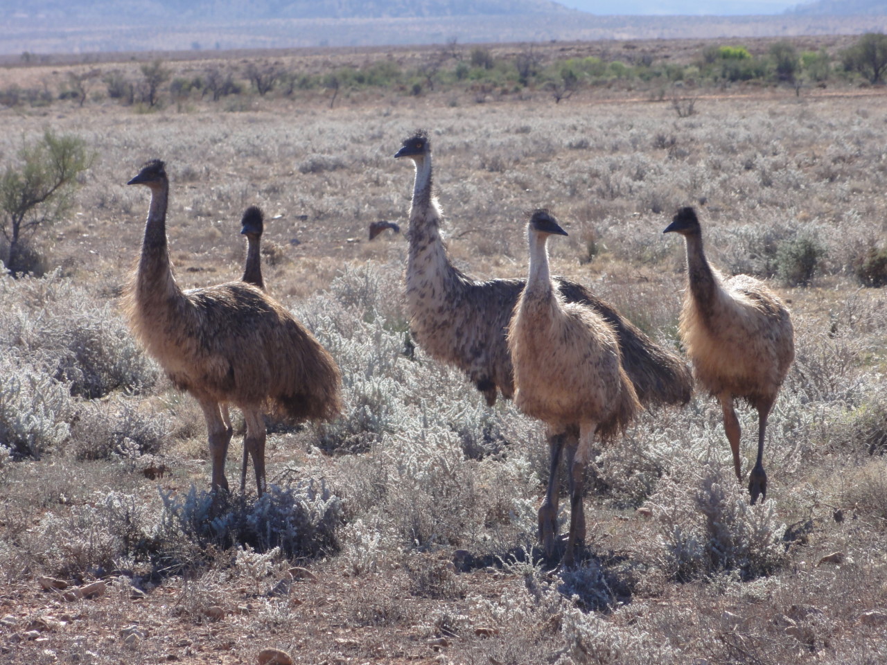
Emus are the only animals that don't seem to mind bicycles. A very curious lot!
Shearing shed at Merna Mora Station.

Self-cooked 7-minute pasta. Yummy!

Day 19: Merna Mora Station to Rawnsley Park (47 kms)
The first 28 kms of the trail are along the Moralana Scenic Drive, which is a gorgeous undulating 4WD track between the Elder Range and Wilpena Pound. Unfortunately, on bicycles, it was quite tiring because of the corrugations. The scenery, however, was fabulous! The last few kms to Rawnsley Park were on the main road (with many road kills, which made the trip a bit smelly!).
Moralana Scenic Drive.

Euros always look a bit shaggy.

Our cabin at Rawnsley Park.

Day 20:
Rawnsley Park to Yanyanna Hut (57 kms)
Another useless loop! This time, however, it was well worth it! The first 10 kms from Rawnsley Park are on a Flinders Mountain Bike Track leading along the slopes of Rawnsley Bluff. The trail is technically a bit demanding and would have been easier to complete without the paniers. The scenery was worth it though! Then another 10 kms on the main road and another gorgeous off-road section to Wilpena. After a pub lunch at the Wilpena Resort, we decided to keep going in order to take a few kilometres off the next day. What followed was the absolute highlight of the trip! One of the best mountain bike tracks ever: a 17 kms undulating (but mostly down-hill) single-lane track through the Flinders Ranges National Park. No sheep, no road kills, just gorgeous native pine forest with the Heysen and ABC Ranges glowing orange in the afternoon sun! For sunset we rode through Bunyeroo Gorge and climbed a very steep hill to Yanyanna Hut. The night was just as gorgeous as the day with a full moon, no wind and relatively warm. Perfect for camping!
Mountain Bike track at Rawnsley Park.

Rawnsley Bluff.


Lunch at Wilpena Resort.

Native Pine Forest in Flinders Ranges National Park.

View from Bunyeroo Valley Lookout - looking back at Wilpena Pound.

Yanyanna Hut and our tent with full moon.

Day 21:
Yanyanna Hut to Blinman (48 kms)
Interesting how the weather changes the landscape! The whole day was overcast and grey, which made everything look dull. We didn't take many photographs. While still in the National Park the track was nice, except for the dozens of dry creek crossings. Most of these crossings are very steep and sandy or rocky in the creek bed, which made them very slow and tiring. Amazing how a landscape, where it never rains, can have so many dry creeks! The last 18 kms of the Mawson Trail are on a sealed road with lots of steep hills. The last marker of the trail points into the Blinman Pub, which was exactly what we needed!I'm sure this would have looked stunning with a bit of sun.

One of dozens of dry creek beds with gorgeous River Red Gums.

The last Mawson Trail markers (four of them!) pointing into the Blinman Pub.

Day 22: Blinman to Parachilna (34 kms) - not part of the Mawson Trail anymore
In order to catch the bus back to Adelaide we had to ride to the closest bus stop, which is Parachilna. The road between Blinman and Parachilna is unsealed and very busy with 4WDs, which made it very dusty for us. Most drivers were kind enough to slow down and by lunch time they closed the road for repairs and we had it all to ourselves! The weather was sunny again and the landscape was just stunning. Most of the day was downhill with some short, steep uphill sections. Parachilna gorge is absolutely gorgeous (haha) with the creek winding its way through steep red cliffs, lined with River Red Gums. Unfortunately, the trip ended with a horrible 10 kms straight road on heavy corrugation. The Parachilna Prairie Hotel was a very welcome sight! We finally met some fellow Mawson Trail riders! Three people got off the bus to start the trail in the opposite direction. In the afternoon we decided to reward ourselves with a 40 minute flight over Wilpena Pound, which was fantastic. What a great finale to a wonderful adventure!!
Parachilna Gorge.

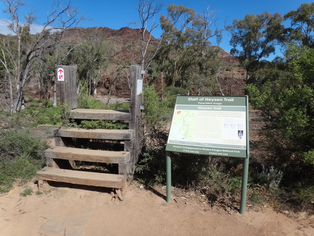
The beginning of the Heysen Trail (for walkers) in the middle of Parachilna Gorge. How come the Mawson Trail didn't get a nice sign-post like this??
Long straight corrugated road to Parachilna.

The Prairie Hotel in Parachilna.


Heysen Range.

Heysen and ABC Ranges.

Wilpena Pound. The shape is best appreciated from the air.

Mawson Trail Summary:
Total distance travelled on bicycles: 1,087 kms
Total riding time: 88 hours
Average speed: 12 km/h
Highest speed recorded: 52 km/h
Total days of riding: 19 (plus 1 day to ride out & 2 rest days)
Number of punctures: 17
Number of Mawson Trail users encountered: 3
Number of Heysen Trail users encountered: 1 group of ~8 people
Number of nights in tent: 3
Number of nights in huts: 2
Total litres of water consumed: 80 - 100
Total packets of lollies eaten: 5
Number of "Golden North Giant Twin" ice creams eaten by Kirsten: 6 or 7?
A campsite without water...hmmm..sounds familiar. All you seem to be missing are several thousand March flies.
ReplyDeleteThanks for this. You met us near wilpena and gave us some advice about the trails. Have ridden bits and pieces of the trail and loved it. Look forward to doing more. Hope your trip home is uneventful and that you have plenty of memories to keep you going. Robert and Mattea
ReplyDeletewell done team. Are you feeling fitter and faster ??
ReplyDeleteHas your time to change a tube dropped ?
have you considered tubeless ??
Where off to next ??
17 punctures?!?!?!?! wow
ReplyDeleteAt dinner with intrepid exploreres
ReplyDelete