Saturday, 6 October 2018

Iceland 2018


Iceland has only one main road and a small population of ~334,000 people. 

Kirsten's cousin and family invited us to join them. We rented campers and circumnavigated the country anti-clockwise starting from Reykjavik. Their luxury home is on the right and our little camper on the left.

Downside: very tight accommodation / positives: 4WD and allowed to drive highland tracks!

Lucky we were invited to dinners and social gatherings! Thanks for all the food and great company!


Icelandic landscapes are stunning when the sun is shining and the sky is blue.....
south coast
4WD track towards Landmannalaugar


coast near Egilsstaðir


Jökulsárlón glacial lagoon, bordering Vatnajökull National Park
Dyrhólaey peninsula
Þingvellir National Park

... and not so much fun when the weather is miserable. We did consider riding our bicycles, until we discovered that the average summer temperature is 10–13 °C, mean percent of sunshine during the day in July is 30%, the average number of rainy days in July is 15 and the average wind speed is >18km/hour. Definitely not the ideal country for bicycle-touring and camping!


My first purchase in Iceland: a 100% waterproof over-sized jacket, which I used a lot!


From inside the car it still looks gorgeous, especially with the rainbows and cloud formations.


According to "Iceland Travel", there are over 10,000 waterfalls in Iceland, some of which are spectacular.
Seljalandsfoss
Svartifoss
Skógafoss
Gullfoss
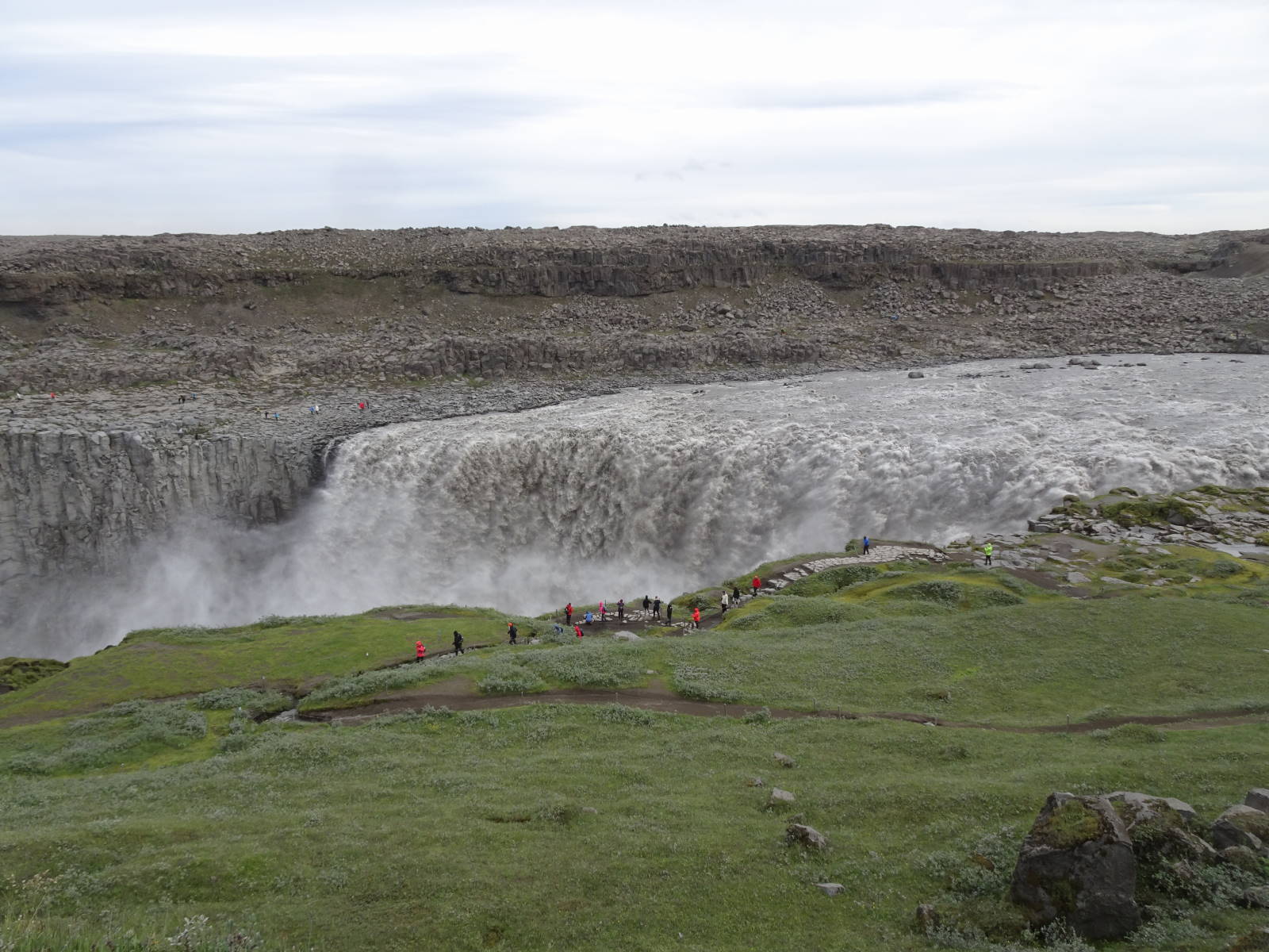
Dettifoss

Iceland is sitting on the boundary between the Eurasian and North American tectonic plates and was created by the Iceland plume, which resulted in constant volcanic and geothermal activity. It is also home to one of the deadliest volcanoes in the world. The eruption of Laki in 1783 is estimated to have killed over six million people globally. The release of 120 million tons of sulphur compounds resulted in a drop in global temperatures, changes in weather patterns, pollution, crop failure and droughts as far away as Europe, Russia, North Africa, Japan and India. Some experts agree that persistent crop failure and hunger resulting from the eruption was the main cause of the French Revolution!
Ninety percent of Iceland is composed of igneous rock and ten percent is sedimentary. Much of the surface is covered in lava with little vegetation, except for the Woolly Fringe Moss (Racomitrium lanuginosum).
moss-covered lava along the south coast

Geological formations are omnipresent, unique and very interesting.
Grjótagjá cave with geothermal hot spring (featured in Game of Thrones)
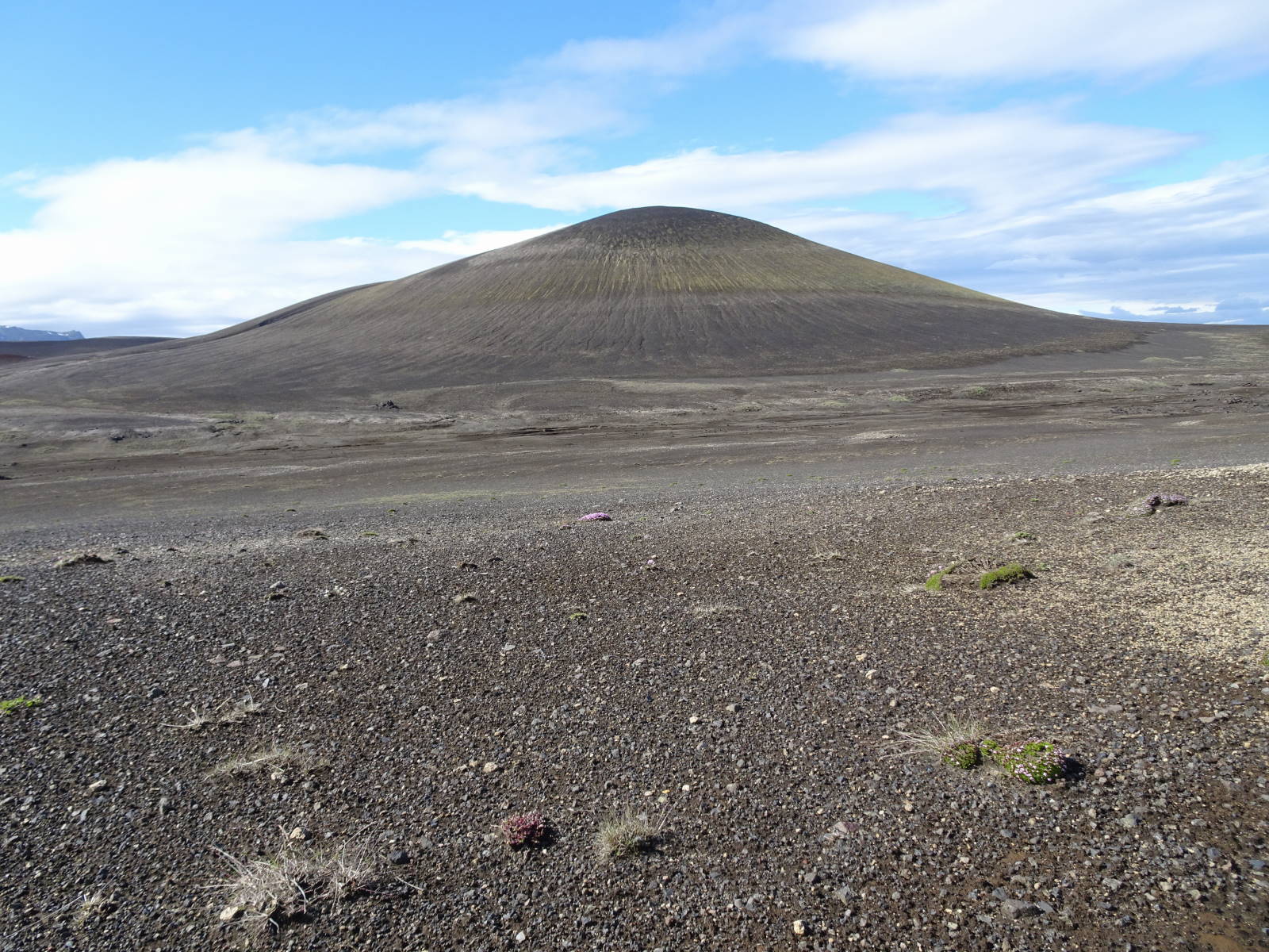
volcanic landscape near Askja
Askja caldera
Víðgelmir lava tube cave

Hljóðaklettar canyon

Námafjall Geothermal Area
Mývatn Nature Baths
dark lava columns at Svartifoss
Fjaðrárgljúfur canyon
geothermal hot spring at Landmannalaugar in the Fjallabak Nature Reserve

Besides the natural features, Iceland has interesting architecture, cute fishing towns and scrumptious food (at exorbitant prices).
Downtown Reykjavik
Harpa Concert Hall in Reykjavik
Hallgrímskirkja in Reykjavik
Icelandic turf houses - new...
..... and original


Djúpivogur
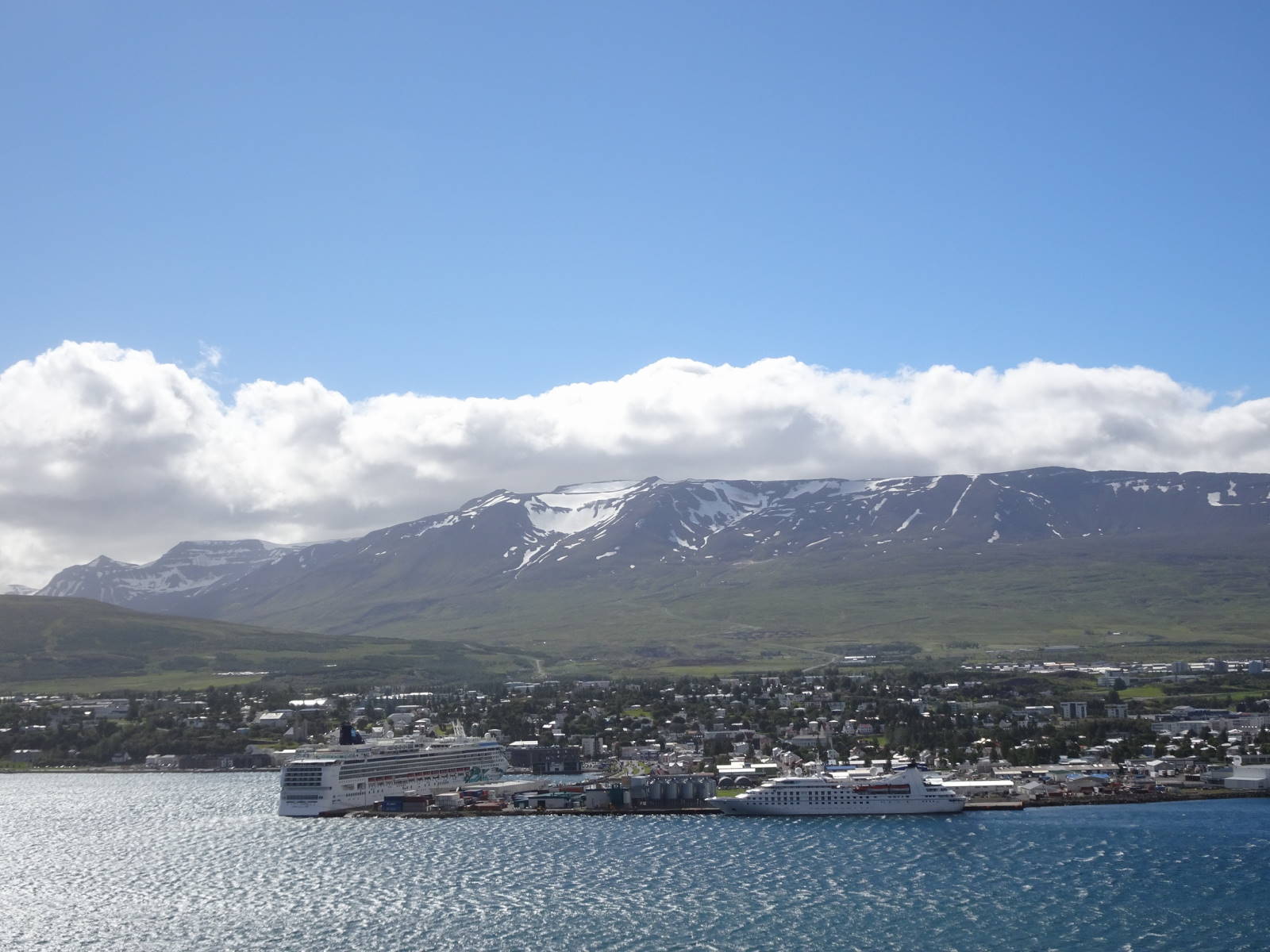
Akureyri
Seyðisfjörður
 
my best meal in Iceland: Langoustine tails baked in cream (Pakkhús Restaurant in Höfn)

Staple food in Iceland includes seafood, lamb and dairy. Hence the most common terrestrial fauna are sheep and cows. Icelandic horses are famous for their longevity, hardiness and five gaits (versus the usual three), the additional two being called "tölt" and "flugskeið", i.e. flying pace (which looks very uncomfortable for the rider!). 
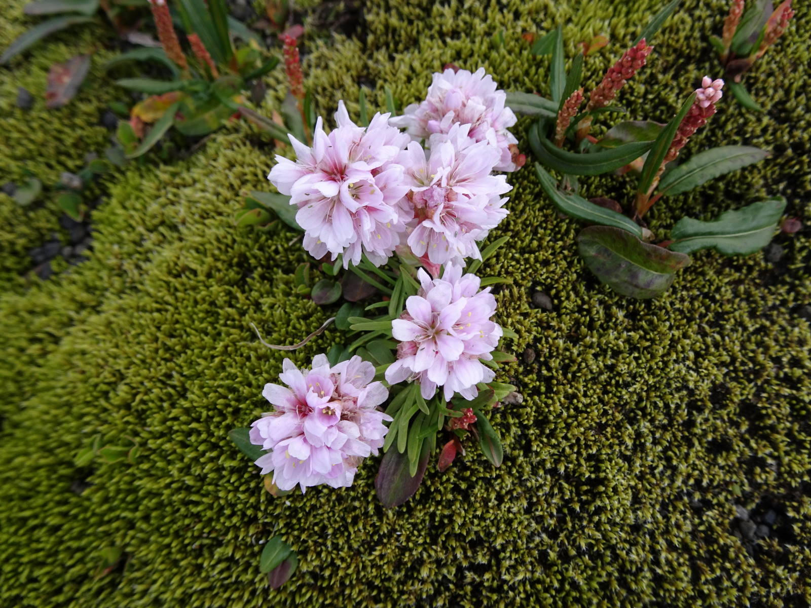
Native fauna comprises aquatic species, birds and the arctic fox. Here are some photos of the flora and fauna regularly encountered in Iceland. 


The Alaskan lupine (Lupinus nootkatensis) was introduced intentionally in 1945 to re-vegetate soil eroded by introduced livestock.

Iceland offers many adventurous activities - not cheap, but heaps of fun! And the perfect uniform, i.e. wet/cold weather protection and safety gear, is always included!


 Photo by Diana Currie


Below a short video of our (underwater) whale watching adventure:

The 4-wheel driving was exciting with many river crossings, soft sand, sharp lava and very steep tracks.


Had enough of Iceland or sad to leave?

Friday, 6 April 2018

BNT - Section 9 (Lithgow to Sandy Hollow)

The Bicentennial National Trail (BNT) is a long distance trekking route, stretching 5,330 kilometres from Cooktown QLD to Healesville VIC. It roughly follows the continental divide and is primarily designed for horses, though mountain bikers and hikers are allowed on the trail as well.

We decided to try our first section of it over 5 days. Lithgow and Musswellbrook are accessible by train, so it seemed like an ideal short trip. The trail leads through Ben Bullen State Forest, Gardens of Stone National Park, Wollemi National Park, Nullo Mountain State Forest and many private properties. The majority of the trail is not accessible to motorised vehicles and there are many locked gates along the way. As a consequence, we had every campsite to ourselves over the Easter holidays!

The trail sign - they are sometimes hard to spot and it is important to have the map and a GPS.


 Our first steep ascent just north of Lithgow, heading towards Wolgan Gap.


View into the Wolgan Valley from the trail, which follows the edge of the escarpment.


Descending to Baal Bone Creek. Even the downhill is too steep and slippery to ride! I am not sure how horses manage not to slip on this.


There is evidence of recent heavy rains everywhere and we had to dodge many puddles.


Camping just below Baal Bone Gap. Unfortunately, there was no water but we managed to get some the next morning from the pumping station at the gap.


Descending through Gardens of Stone National Park into the Capertee Valley. At Glen Davis we had a long break to escape from the heat. The campground/community centre provides free drinking water, shaded picnic tables, flushing toilets and even showers!


Shortly before sunset we pedaled another 12 km to Glen Alice, where we camped next to Umbiella creek with an amazing view of the red escarpment. Yet again, the RFS/community hall provides drinking water, picnic tables and flushing toilets.


Riding north along the Upper Nile Road was an easy start to the day.... until the trail followed a firetrail uphill! An ascent of 500m over 2.5 kms.


Kirsten at the beginning of the toughest ascent yet. Some sections were so steep and slippery, it took both of us to push one bicycle. It took us 3 hours to climb the 500 m in elevation.


Taking photographs of the gorgeous landscape was a welcome break.


The view from Grassy Mountain towards Capertee Valley where we came from.


The small shelter at Grassy Mountain provided welcome shade and drinking water. We stopped for the hottest part of the day and cooked many cups of broth, tea and hot chocolate to re-hydrate and re-energise.


The afternoon was spent riding through the beautiful Wollemi National Park. This section of the trail was amazing to ride, slightly undulating terrain, soft surfaces and stunning trees! Another campsite all to ourselves at Cudgegong River.


An easy day of riding through State Forest and private properties and (apparently) within a couple of kilometres of the famous patch of Wollemi Pines (which is not a pine but an Araucaria). The oldest fossil of the Wollemi Pine has been dated to 200 million years ago.


We decided to stop early at Sandy Camp Hut and camp for the night. We loved the remote wilderness and could not face the Easter crowds in the valley and busy roads.


Time to wash some of the sweaty gear!


During the early-morning descent into the Myrtle Valley our track turned into a wet paddock and left us splattered in cow poo!


Heading into the Widden Valley towards sealed roads, civilisation and busy Easter traffic.

Another fabulous bike ride - if one doesn't mind a bit of pushing and lifting the gear over locked gates!