Monday, 5 May 2014

South-western WA

From Denmark we rode a 3-day section of the Munda Biddi Trail, which was closed in October 2013 when we did the 3-week ride. Great to be back on the bikes after all that walking!

This turned out to be the last sunny day for over two weeks!

One of the fun sections....

.... and another one. We love those signs. Just bikes on a single-file track!

Another Munda Biddi hut in a stunning patch of forest.

Western Australia has such an amazing coastline with clear blue water, white sand and interesting rock formations. Below the Conspicuous Cliffs in the Walpole-Nornalup National Park.

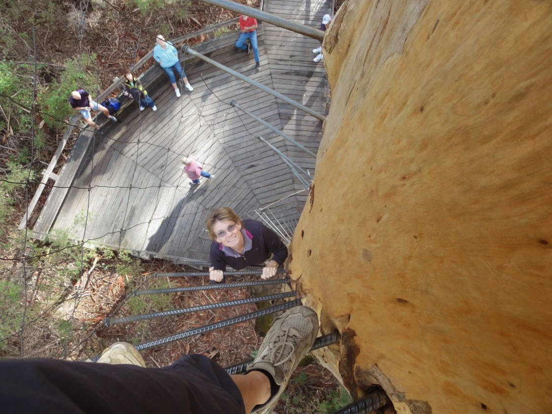
The Karri forests around Pemberton have been logged for a century. As an early warning system to prevent large forest fires, the tallest trees were manned with smoke-spotters. The trees were climbed via metal stakes spiraling around the trunk. Three of these trees can still be climbed, one of them 70 m tall!

The chicken mesh is supposed to be a safety feature, but does not provide much confidence! I was too scared to go all the way!

WA has some very colourful parrots, a Western Rosella (Platycercus icterotis) below.

The Yeagarup Dunes are a massive land-locked mobile dune system that is moving slowly inland, swallowing the forests and wetlands in its path. Another fun 4WD we couldn't miss!


The white dunes can be seen in the background.

We found this bike park by accident and of course had to try it. We rode the blue and the purple track but never got airborne on the jumps - we're obviously too slow!

Cape Leeuwin is the starting point of the famous "Cape to Cape" Walking Track, which runs for 135 km along the Leeuwin-Naturaliste Ridge. Another thing left on the to-do-list.


The geology between the capes is mostly limestone and there are hundreds of caves. Some of them are open to the public, Lake Cave being one of them. The cave entrance is visible in the bottom left corner of the photograph.    

The "floating table" is attached to the ceiling by two stalactites. Note the reflection in the lake!

I loved the many straws, i.e. stalactites in the making.

This is why caving is not for me! Too tight and dark! This trial squeeze wasn't even wet, cold or muddy yet!

Some more amazing Karri forests!

The Canal Rocks are lines of Gneiss battered by the Indian Ocean, forming very unique underwater channels. We would have loved to go for a snorkel but the water temperature was 15 degrees!  


A short glimpse of the sun in Busselton. The jetty is almost 2 km long and was used to load timber onto ships.

The next day the sky was back to grey. Imagine how blue the water would be with a bit of sunshine!


These weird "rocks" are thrombolites, an ancient microbial photosynthesizing community.

It's time to head north, the days are getting too short and autumn has definitely set in.

Wednesday, 23 April 2014

Via Stirling Range to Albany

The Holland Track is a 350 km 4WD track from Kalgoorlie to Hyden leading through gorgeous woodland dominated by Gimlets (Eucalyptus salubris). It took three days to complete with two nights of bush camping.

Some Gimlets are almost chocolate coloured!

My favourite afternoon past-time: plotting a route while drinking a beer. 

This cockroach was 5cm long! And what amazing colours... 

Who says I can't catch a wave! Some silly person actually left a surfboard at Wave Rock.

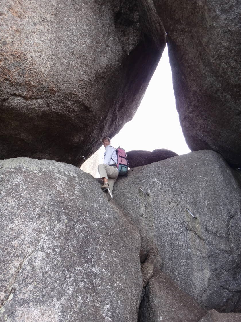
We have now climbed so many granite boulders and they are still beautiful and unique.

Mulka's Cave in the Humps contains some of WA's most significant aboriginal art. 

The rugged peaks of the Stirling Range abruptly rise from the surrounding landscape and are a hotspot for biodiversity. Eighty flora species are only found here!

Bluff Knoll (1,095 m) is the highest peak, very steep and a popular bushwalk. Lucky we started early! We took a long time to come down because we had to let everybody pass who was going up (the swiss alpine etiquette).

We got up at 4 am to watch the sunrise! It was only 12 degrees and we waited for hours for the sun to appear behind the clouds!

The day we climbed it, the top was covered in clouds and ....

.... we only got a 30 second glimpse of the parking lot below. At least it made the 600 m drop less scary.

The climate on top is alpine and the vegetation is very different from lower parts of the range. The fact that everything was covered in dew made it even more interesting! 


Sunset from our camp with the western part of the range in the background.

Below Bluff Knoll seen from Mount Trio (856m).

Just south of the Stirling Range is Porongurup National Park, where massive ancient granite domes rise up to 670 metres. Here is me climbing up to the skywalk at Castle Rock.


The lower parts of the park are covered in gorgeous karri forests.

After the Easter crowds have left, we are back on the coast. Albany harbour....

.... and Torndirrup National Park.

Monday, 14 April 2014

Kalgoorlie

On the way to Kalgoorlie we camped at Peak Charles National park. After the busy Cape Le Grand National Park we loved the solitude!

The top of Peak Charles was too scary to climb, but the view from just below the summit wasn't bad either. The area forms part of the Great Western Woodlands, a 16 million hectare woodland/heath interspersed with salt lakes. It apparently contains 20% of all Australian flora species!


At Kalgoorlie we visited my friend Leana and did a tour of the KCGM mine. Gold was discovered here in 1893 and the Super Pit now produces over 22 tonnes/year. One tonne of rock contains only an average of 2.5 grams of gold. That's a lot of rock to move, crush and process!

The pit is over 600 metres deep, approx. 3 km long and 1 km wide!


The size of everything is staggering! Every one of these trucks costs $17 million and each tyre $38,000! Haha, no wonder they like women driving them!
Note the little white dots on the parking lot are "normal" sized cars.

Kirsten looks good as a miner!

Kalgoorlie town centre below. The town has gorgeous old buildings and nice pubs (with topless bar-maids). Due to the proximity of the Super Pit, the whole town shakes every time they blast a new section of rock (which happens at least twice a day!).