Tuesday, 1 April 2014

Eyre Peninsula

Whyalla on the Spencer Gulf is a town built by BHP (now OneSteel) due to iron ore deposits found in 1899 at Iron Knob. The Steelworks are still active, producing structural steel and railway lines. The HMAS Whyalla was built in the local shipyard in 1942 and decommissioned in 1984. All very interesting...

... except that the town is covered in red dust and the water in the Spencer Gulf is not very tempting for swimming.


Once we arrived in Port Lincoln, things improved: a night in a fancy new hotel, excellent seafood and two National Parks nearby.

Port Lincoln is called the "Seafood Capital of Australia" and is reputed to have the most millionaires per capita in Australia. The fishing fleet is impressive!

Lincoln National Park boasts scenic coast lines, secluded bays, excellent fishing ...

... and great camping spots! 

Some people catch so much fish, they can't eat it all. We received some King George Whiting caught two hours earlier. Delicious!!

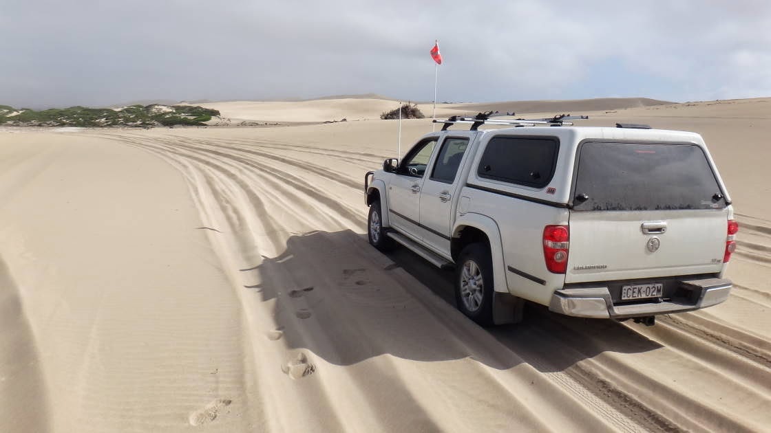
The Sleaford-Wanna sand dune system is a playground for 4WDs. Of course we could not miss this, lowered the tyre pressure and got the sand flag out for our car. There was nobody else out there! Absolutely fantastic!

Kirsten doesn't get to drive all the fun bits!


Note the size of these sand dunes with the car looking tiny! And totally white and soft!

The driving was not too challenging, except for one section, where of course I did not have the camera ready. When I asked Kirsten to drive through it again, she refused, saying "that was not pleasant".

There was no track, just a few red markers to indicate the direction to the other end of the 10 km long dune system.

Yangie Bay in Coffin Bay National Park. Apparently the name has nothing to do with dead people but a name of a friend of Matthew Flinder's who mapped this area in 1802.

Coffin Bay is a sleepy fishing and holiday village.

Below some of the coastline along the west coast of Eyre Peninsula.


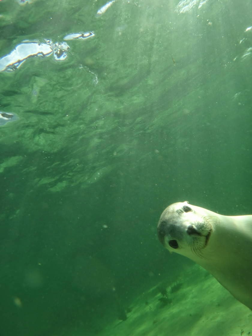
The "Baird Bay Ocean Eco Experience" (www.bairdbay.com/) offer a trip to snorkel with dolphins and sea lions (in 16 degree water!). The dolphins seemed to enjoy playing in the wake of the boat more than to interact with the swimmers. The sea lions, however, loved the interaction. They are very cheeky and playful! What a fantastic wildlife experience!

By the way, the tour guide was wearing a shark shield - great white territory! But we survived.

I couldn't take a shot without him in it!


The coast has interesting rock formations due to porous limestone sitting on top of smooth sandstone. Here the Woolshed Cave...

.... the sea lion colony at Point Labatt, ...

.... and a fantastic snorkelling spot called "the Granites".

Streaky Bay was packed with grey fishing nomads (we were the youngest people in town, apart from the two German girls in the VW Van next to us, haha!). Apparently it's the best time of the year to catch King George Whiting.


On a quick detour to the Gawler Ranges National Park.... 

.. we climbed a lot of weird granite formations. Mt Wudinna is the second largest rock in Australia (after Uluru), i.e. a huge monolith. Pildappa Rock, a smaller version, below.


Murphy's Hay Stacks below. 


The organ pipes in Gawler National Park formed as a result of volcanic eruptions more than 1500 million years ago. Some of them have now toppled over.


Saturday, 22 March 2014

Barossa Valley & Flinders Ranges

We met some friends and family in the Barossa Valley and spent a few days with great company, good food and excellent wine. Thanks everybody for making it so much fun!

"Life is too short to drink bad wine." Johann Wolfgang von Goethe. How true!

In 2012 we rode our bicycles from Adelaide to the Flinders Ranges and loved it. From the Barossa, the southern part of the Flinders is only a 200 km detour, so we decided to head north instead of west. Here's our camp for 3 nights in Wilpena.

The creeks are lined with very old River Red Gums (Eucalyptus camaldulensis). Their bark is so beautiful with all the different colours and patterns!


On arrival we rode our bikes into Wilpena Pound and climbed a lookout. The inside of the pound is not as spectacular as the outside walls and the sign below explains why.


On day two we climbed Mount Ohlssen Bagge (the name of the surveyor's business partner). What a great view of the surrounding areas!

The vegetation on top is amazing ......


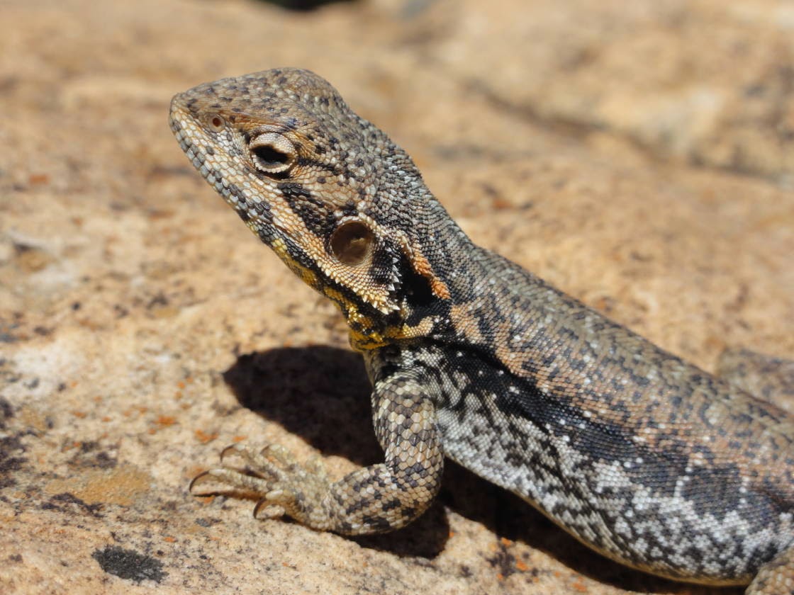
.... and the Tawny Dragons (Ctenophorus decresii) are very cheeky.

By early afternoon the temperature reached 36 degrees and it was time for a cold beer! 

On day three we rode our bicycles along the Mawson Trail to Bunyeroo Gorge and back. This was our favourite part of the trail, all downhill along the spectacular Heysen Range (except that now we had to ride back up to Wilpena!).

It's easy to understand why Sir Hans Heysen was so inspired by this landscape!


Before turning back we decided to do an 8 km walk into the Bunyeroo Gorge and back. It was another 36 degree day and riding the bikes up the hill was pretty tough!


On the way to the Gammon Ranges we camped in Mount Chambers Gorge. Just us and 2 million flies! 

The gorge has aboriginal art, which we inspected during an early morning walk.

Guess what this string across the road is?

An army of caterpillars marching single-file!

Wednesday, 12 March 2014

Heading West

We are off again! This time heading west as far as possible without getting wet and then north.
Cocoparra National Park near Griffith was our first National Park along the way. It is very small and dominated by goats, but nevertheless a nice change from agriculture and grazing land.


In Yanga National Park we camped on the Murrumbidgee River. When we came through in 2012, there was floodwater everywhere, now it seems to have returned to normal and the River Red Gums look healthy.

Yanga Wool Shed - they used to bring paddle steamers all the way up here to transport the wool to the market.

Hattah - Kulkyne National Park in Victoria: much of it is still flooded and with blue-green algae levels above the recreation alert level, we decided not to camp there.

What a gorgeous Eucalyptus! Bright red operculums and yellow flowers. If it's what I think it is (i.e. Eucalyptus erythrocorys) it is not supposed to be here, it's endemic to WA. But then again, I'm not a botanist.

The pink lakes at the southern end of Murray-Sunset National Park were used for salt mining until 1979. The pink colour is apparently caused by a beta-carotene producing algae.


My first beer after a month off the grog! Just in time with 42 degrees at 7pm! 

What a gorgeous spot and all to ourselves!


Kirsten thought over 40 degrees was too hot for camping, so we dropped south to the coast, i.e. the Coorong National Park. Night-time temperature now 17 degrees!

The size of the ants here is scary and check out the mandibles! Lucky they were not very aggressive!

This is a water well built by the Chinese when they walked 800 km from Port Augusta to the Victorian Gold fields in 1850!

The wild Southern Ocean! Too cold and too rough to swim!

The Coorong is a 130 km long saltwater lagoon/wetland at the mouth of the Murray River. It is protected under the Ramsar convention due to its environmental significance such as breeding habitat for threatened species and migratory birds. Last time we were here it was at the brink of environmental collapse, due to a lack of water coming down the Murray, which lead to very low water levels, acidification and high salinity. It seems in much better condition now!

Is this where Mr Percival lives? For our international readers: there was a famous book/movie produced here, called Storm Boy, with one of the main characters being Mr Percival, a pelican.


At the northern end of the Coorong, there is a small aboriginal settlement. See if you can find this church on a 50 dollar note!