
After the devastating floods in Queensland in March 2025, the water made its way to the Channel Country and started filling up Lake Eyre by May. The Lake Eyre Basin is one of the world's largest internally draining river systems, i.e. the water never reaches the ocean. The size of it is a staggering 1.2 million square kilometres. The lowest part of the basin is Kati Thanda or Lake Eyre, which is Australia's lowest point at 15 metres below sea level. The lake usually contains little or no water as the entire catchment is within Australia's arid zone.
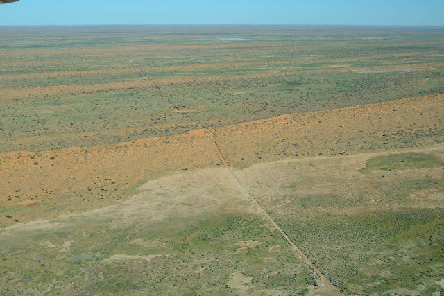
The Channel Country is an area of ancient floodplains and braided rivers that only flow intermittently. The principal rivers are Georgina River, Cooper Creek and the Diamantina River, all draining into Lake Eyre. In most years flood waters are absorbed into the earth or evaporate.
I was watching the water's progress on Sentinel 2 satellite imagery (accessible via Copernicus Browser by the European Space Agency). The Normalised Difference Moisture Index (NDMI) is a combination of spectral bands that visualises moisture levels. The difference between January 2025 and May 2025 is amazing! When I read that the Diamantina River was over 30km wide, I decided to book a trip to see it from the air.


Birdsville is a small town founded in 1887 and situated near the Simpson Desert with a permanent population of 110 (except for very hot summers where it's usually half that). The iconic Birdsville Hotel is owned by Courtney and Talia Ellis (https://birdsvillehotel.com.au). Talia, being a bush pilot, offered eight extraordinary 5-day tours during May 2025 to see this spectacular event from a 12-seater Cessna Grand Caravan.
Day 1: Meeting the group in Longreach, which is the birthplace of Qantas and the home of the Australian Stockman's Hall of Fame.


Day 2: Flight from Longreach to Birdsville via Windorah for refuelling and Innamincka for lunch. Views included the Cooper Creek catchment, Coongie Lakes and the Goyder Lagoon.
Longreach

The passengers..

The usually sun-scorched arid landscape has now burst into colour and life!


Birdsville

Airplanes are parked right outside the pub!


Day 2: 4WD to the Simpson Desert and Eyre Creek, the largest parallel sand dune desert in the world. The desert crossing takes 3-4 days and leads over 1,100+ red sand dunes. The largest dune is "Big Red" 35km west of Birdsville. 


Due to the floods all tracks through the desert were closed and Eyre Creek was impassable.

The desert was full of colour and life!

Do you mind?


There were hundreds of shield shrimp in the water between dunes!


And to top it all off: sunset from Big Red!


Day 3: Flight along Eyre Creek, Simpson Desert, then back over Lake Machattie and Diamantina rivers. Such widespread floods of the Georgina River, Eyre Creek, Diamantina and Cooper Creek river systems at the same time have not happened for decades.
Big Red looking East. There is a very steep lip at the top of each track.

Track driven the day before with Eyre Creek channels in the background.


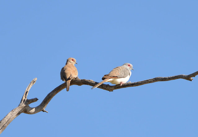
I spent every sunrise at the Birdsville Billabong. Not too many birds yet, since the flood only just peaked.


Whistling Kite

Spoonbills

and of course Galahs and Corellas


Day 4: Flight back to Longreach over the Diamantina braided river system.


What a fabulous trip this was! Thanks Talia!
